TDC Me

Your Say

Together we can achieve more

  • Home
  • Inclusive Council
  • Environment
  • Water
  • Housing
  • Business
  • Transport
  • Dam
  • Contact
  • About
    • Testimonials

Dam Budget Bombshell

05/07/2018

waimea dam budget bomb

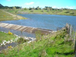
Early indications of huge blowout in the Waimea Dam price call into question the entire dam process to date.

Today, Councillors were called into an extraordinary briefing session ahead of the Community Development Meeting where we were informed of a press release going out within minutes stating that there are “significant challenges” with the early dam pricing to achieve a within budget price.

I asked for an indication of what aspects of the dam they had an indication were running over budget – they could not tell me.

I asked what kind of budget blowout range we are talking. Again, they were unable to tell me.

I stressed that they felt it important enough to call an extraordinary briefing and go out with a press release and yet they are telling me that they have no idea of what kind of early indication budget blow out we are talking about. They confirmed that was the case.

We were told that the press release was to address the fact that there is already information “on the street” about the dam budget being insufficient. This is interesting given the ridiculous conditions that they suggest at the last council meeting be imposed on Councillors wishing to view the dam Term Sheets with our partners. It also supports the Councillor’s decision not to accept personal liability for the leaking of information when this dam is already full of leaks. Leaks that could not have come from Councillors as we are not allowed to know any information at all around the current pricing of the dam.

The fact that staff were unwilling to suggest any kind of price range leaves one to speculate that is so far away from the budgeted figure that there is no likelihood we are going to be able to achieve a dam. If that is the case then there are some serious questions that need to be answered.

Do council staff have the experience to manage a project of this magnitude?

When the current members of the Council table wished to revisit the “plan B” options a revised estimate of each project was produced. Without exception every other option had the budget increased by 2, 3, even 4 times the budgets originally presented to council. It turns out that the projects were not fully scoped and there was an array of reasons why the budgets had to be revised to be accurate in the current market.

I asked for a similar review of the Waimea Community Dam as my own assessment, and the advice that I was receiving from experts in the fields of forestry, earthmoving, and even dam building was that aspects of the budget were seriously deficient. The assurance that I was given by staff on numerous occasions was that we are confident that the pricings were accurate. Various aspects of the project along the way we were told were coming in within the budget range. We have been repeatedly assured by our staff, and by the likes of John Palmer, that this budget was so robust we could be 95% sure it will come in on budget.

Why this is important is because Council has elected to continue spending money on the Dam project based on this advice. I am sure it was this advice that the Mayor relied on when he used his casting vote to increase the dam budget by $3million dollars. It was also on the back of this information that the Council elected to proceed with the early contractor engagement process (ECI) to get a finalized quote for the dam – also costing the Tasman ratepayers a significant amount of money.

If the dam fails to proceed due to excessive budget blowouts I feel somewhat responsible as a Councillor. I have failed in my role as governance to monitor the process adequately before we ended up with a $10million bill for a dam project that was not affordable. However, I have been asking questions for the past 2 years, I just have not been getting all the information to make a better-informed decision.

When the irrigators were telling us that they could not afford their share, and urban water users and ratepayers who already paying some of the highest rates in the country could not afford more than their share, I questioned how we could proceed with the project. I should have insisted more strongly that we revisit the viability of the dam.

When I was repeatedly told that we had sufficient budget for aspects of the dam that were clearly under budgeted I should have insisted on further investigation. When I was told that I could not view Term Sheets or the Schedule of Risk I should have insisted as governance that I have a right to view such crucial information before making decisions around the dam.

Mayor with his head in sand
Mayor takes stand on Dam

Alarm bells should have gone off when the Mayor insisted that he did not want to see Term Sheets or the Schedule of Risk. As someone who reserves the right to vote twice (despite my attempt to remove that right) the Mayor should be extra well informed on significant projects that he is voting on, and yet he does not even want to know how much the early quote indication is over budget (as quoted here). Questions have been raised in the community if he is up to the task and I am struggling to find evidence to suggest that he is. Certainly, Mayor Kempthorne’s current approach of burying his head in the sand at every given opportunity does not suggest he is capable of leading significant projects.

Now that we have been given no indication of how much the budget is looking likely to blow out by we are left in the position of assuming that it is as stated in the press release a “significant challenge.” My next line of questioning is how can we trust any figures that we are presented with in the future. If they manage to get the price within budget (or close to it) I will be wondering what corners have been cut to achieve it? What risks have we taken onboard that will result in huge overrun expenditure that the ratepayer is solely liable for because the irrigators have capped their liability?

If the initial estimate was only marginally overbudget you could imagine that things could be tweaked to bring the quote into alignment with the budget. However, a “significant” (staff wording) gap can only be closed by taking shortcuts or a complete redesign. We only have to look across the boundary at the Stoke Greenmeadows project to see where corner cutting and budget skimping leaves a project

I have to say that I have gone from dam sceptical to thinking that those members of the community who have been calling for a judicial review into the process may indeed be barking up the right tree. Ratepayers have a right to know how 10 million dollars of their money could possibly have been wasted on a project that had no way forward. Land acquisition is still far from a certainty, the initial budget was apparently woefully inadequate, consultation and deliberation was dubious at best, what else is yet to be shaken out of the tree?

Like all other ratepayers, I will eagerly wait for a council press release to find out what is going on with the dam!

Filed Under: Projects, Your Say Tagged With: budget blowout, dam budget, Waimea dam

Grandstand Dam Long Term Plan

04/07/2018

Sign up for a grandstand or a dam

The 28th of June full Council meeting should have been about Council adopting the Long Term Plan. However, it was overshadowed by a couple of other agenda items. View the agenda here.

A surprising turn of events saw those on council who wanted to raze the Takaka grandstand to the ground do an about face. One wonders what persuaded the change of heart when a petition of over a thousand signatures, a demonstration outside council, a multitude speaking in the public forum, and numerous emails wasn’t enough last time we voted. Maybe the TV cameras filming people in chains was a little harder to ignore?

While the Grandstand execution order has been lifted there is a long way to go before the old lady of the Bay can rest in peace. There are a lot of issues to come out of the woodwork to satisfy the Council compliance team. The success of the in-situ restoration bid will largely depend on the ability of all the stakeholder groups to put the past and egos behind them and find enough common ground to work together for the good of the grandstand.

Other agenda items were no less surprising. Councillors were recommended by staff to sign a waiver of councillor privilege and take on personal liability if we wanted to view the Term Sheets in relation to the dam. They stopped short of insisting on a strip search but required that we book a time to view the documents. We would then be allowed access to them in a secure controlled room where we were not to take any copies, electronic or otherwise, of the individually identifiable documents. If our document was proven to be leaked then we would be personally liable for the breach.

dodgy salesman picture
Sign Here … trust me, its the best deal for us.

What staff didn’t explain was how our personally liable documents would be securely stored, who would have access to them, what supervision would be in place for anyone that had access to them. They also admitted that our staff that had access to the current documents did not have similar requirements, nor did the members of WIL that had access to the documents – even the Term Sheets between CIIL and TDC (rather bizarre I would have thought).

This overreaction in it self leaves one wondering what they are hiding. An earlier version of the Term Sheets was circulated with councillors without such extraordinary security precautions, so what has changed? According to the staff report councillors have “previously been made aware of the key conditions in the Term Sheets” so this is rather extreme to be protecting the non-key conditions surely?

Of course, there were those around the table that did not want to see the Term Sheets. Although, at least one of those councillors wanted “all the information” before making a decision on the Grandstand. A cynical person might say that this selective interest in getting all the information on topics seems to be related to the outcome desired by the individual councillors rather than a reasoned and fair-minded approach.

Another example of this would be a referendum on the Waimea Dam, twice denied by Mayoral casting vote. Yet on the topic of the Public Water Supply Bylaw Review the Mayor is recorded in the latest Engineering Committee minutes as saying “… that without the Waimea Dam there will be significant changes to the District’s water supply during dry summer months. He said that the proposed bylaw clarifies those changes and that it was important to consult with the community.”

It is very important that we have all the information, and the community have a voice, when it comes to water restrictions applying particularly in a no dam scenario. I can hear that cynical ratepayer making a snide comment about this being an attempt to scare them into paying for the dam. However, the current Tasman Resource Management Plan provisions in the event of a no dam scenario will require drastic water cuts should we face dry weather.

It is a pity the community doesn’t have a voice when it comes to expressing an opinion over water restrictions verses unaffordable rate increases when the dam runs over budget don’t you think? The Mayor doesn’t think so.


Filed Under: Spending, Your Say Tagged With: Takaka grandstand, Tasman District Council, Waimea dam

No Vote On Dam

25/05/2018

No Choice

Mayor Kempthorne confirmed that there would be no vote for the ratepayers on the Waimea Dam in the Council meeting 24.5.18. Not once, but twice, he used his casting vote to ensure that there would be no referendum on the dam. This despite assuring people around the district at the last Annual Plan consultations that they would get a Yes/No vote on the dam.

Councillor Greening moved that we hold a binding referendum on the receipt of an accepted tender price.

Councillor Bryant seemed to be confused at to what an accepted tender price meant which is a little concerning given that he is Chair of Engineering.

Councillor Brown said the community couldn’t be expected to be well enough informed to make a decision on whether or not we should proceed with the dam.

The vote came in 7 for 7 against. The Mayor voted again to bury the motion.

I had foreshadowed that I would move, that we hold a non-binding referendum on the receipt of a successful tender price, in the event the first motion failed.

Again, we got to hear how disappointed some councillors are that there is a need to waste $80,000 on hearing from the ratepayers (the same councillors that I believe voted to spend $80,000 on temporary seating for a rugby game).

There was also discussion that as councillors we are called to make governance decisions. Apparently, we don’t need all the information to make those calls.Build the dam

Councillor Greening asked why they were afraid to consult the district if they believed that there was genuine widespread support.

Again, when the motion was put to the vote it was tied 7 for 7 against, and again the Mayor voted twice to kill the motion.

We will now be in a position where we have to vote on the project without a mandate from the district. The Long Term Plan feedback that we received was a majority (around 80% of the 1,300 plus submissions received) against the dam. We were encouraged to ignore these submissions because they are such a small representation of the population in the district. But the Mayor will not allow us to poll the whole district.

This is in my opinion a poor display of leadership. The same poor leadership that refused to allow a referendum to be held in conjunction with the next Council elections over whether or not we switch to the STV style ballot (the same as the health board use) for future elections. This was rejected despite the fact that the Mayor knew there was a petition circulating that would force a referendum on the topic if they achieved the appropriate number of signatures.

We are now in a situation where the petition is likely to have the signatures required and if they present that petition then Council will be forced to go to the polls within 3 months (at the cost of $80,000). The petition holders could be forced to present their petition sooner than 3 months prior to the next election or it could be invalidated. This whole debacle could have been easily resolved by council agreeing to hold the referendum anyway – this option is no longer available to council because of electoral act regulations.

Win/win solutions are not our strong point. As the bulldozers line up against the Golden Bay Grandstand we can mourn another lost opportunity to find an amical solution. Had this been the Richmond Grandstand I am sure we would have worked harder to solve the problem before we were left with a divided community and a pile of rubble. There were no winners in today’s vote.

The adoption of the Long Term Plan by the majority of the Council signalled the continued willingness by the majority to spend money on a dam project that has taken on Lotto-like odds of achieving successful completion. The risks surrounding the project are growing by the day. The proposed governance structure has little if any benefit for the ratepayers footing the majority of the expense both in construction and in ongoing maintenance.

While only a relatively small portion of our overall expenditure in the 10 year plan as the Deputy Mayor repeatedly points out, the dam is the project that carries the most risk, consumes the most discretionary budget (such as the income from forestry), and rates people the hardest (especially those within the zone of benefit and those connected to the already expensive-by-national-standards urban water club).no hear, no see, no speak

What started out as a good idea has become an endless pit into which we are prepared pour money. I questioned months ago how we could continue with a project that the irrigators claimed they couldn’t afford their share, the urban water club couldn’t afford their share, and we had general ratepayers telling us they couldn’t afford their share.

Our LTP clearly states that debt, rate affordability, and a financially prudent strategy are our goals. Our actions do not deliver that in my opinion, hence my futile vote in protest against adopting the LTP.

Filed Under: Your Say Tagged With: Waimea dam

Dam What Is It Costing Me

14/11/2017

what will the dam cost me

Number Crunching the Dam

One of the main questions arising around the dam is “How much is it going to cost me?”

I will endeavour to unpack the figures as they have been presented. One staff member was explaining that these are the worst-case scenario, these are not the worst-case scenario, these figures are the total currently budgeted cost should the dam come in within the $82 million figure (that includes a $13m contingency).

pie chart of dam capital fundingIn this world of what I would call best-case scenario:

  • The Government will pay $7m from the Freshwater Improvement Fund.
  • Nelson City Council will contribute $5m (or TDC will contribute an extra $5m).
  • Crown Irrigation (CIIL) will loan TDC $10m interest free.
  • Waimea Irrigation (WIL) will contribute $15m.
  • CIIL will loan WIL $22.12m – up to $23.62m with over-runs (that  TDC will underwrite to the value of $29m including costs).
  • TDC (you the rate-payer) will contribute $16.8m.


Total costs to the rate-payer should everything fall within contingencies is $16.8m + $10m (+ $29m underwrite).

These are the figures used to calculate how much rate-payers around the district will be contributing. Should NCC not contribute $5m that will be additional to the figures quoted, as will any cost over-runs.

To date TDC has contributed $6.5m according to figures released.

TDC dam contributions to date

This figure includes money gathered through a targeted rate on irrigators. It does not include contributions from the Government and other sources by way of grants, and a lot of staff time and miscellaneous costs that were not directly billable. In other words, the dam project has had well over $6.5m invested in it to date, a significant portion of which has been contributed by the general rate-payer. Something to consider when contemplating should we proceed with the dam.

What Does It Cost Me?

This will depend on where you live and whether you are a water user.

The following chart gives an indication of what you might be expected to contribute by way of rates depending on your circumstances.

Chart of potential charges for rate-payers in relation to the waimea dam

Everyone can expect to have the Fixed District Charge of $29 added to their rate bill each year once the dam has been constructed. Remembering that these charges will be phased in during construction so will not appear in full should a green light be given to go ahead.

Those who live in the “Zone of Benefit” can expect a charge related the capital value of your property of around $56 per million of capital value (a calculator is available on the TDC website). This zone of benefit is an arbitrary line that has been drawn approximately around the rate-payers that could potentially be supplied with TDC reticulated water from bores benefiting from the dam. The location of this zone is not an exact science and will undoubtedly cause discussion wherever it is drawn from people just on one side of the line or the other (especially if your property fall just on the rated side). It is an attempt to justify that some people will receive greater benefit than others in Tasman region.

The map of the Zone of Benefit is as follows:

zone of benefit charges map

If you are unsure what side of the line your property falls TDC staff will be able to clarify this for you.

On top of the District Wide $29 and the Zone of Benefit charge is also a Water User charge. For those on a council reticulated water scheme that is included in the urban water club/co-op (Motueka urban supply is not) there will be a 10% increase in your water meter charge and your per m³ charge.

In short, everyone will be paying the district rate (proposed $29) and some people will be paying either the urban water charge or the zone of benefit charge, and some people will be paying all of the above. A small minority will be paying a selection of the above AND the not insubstantial cost of affiliating to WIL.

Remember that these charges do not include an NCC failure to contribute, nor do they include the potential for the dam to over-run by an unlimited figure. Another point to remember when calculating your rate bill is that they do not include the impact that the current round of property re-evaluations will have on rates, nor do they include the effect of any other capital expenditure that the council will be budgeting for.

As a council we have been looking at the projected budget for the next Long Term Plan and it will be a challenge to put it politely for the council to remain within the 3% rate increase cap over the short term. It will also be a challenge for council to remain within the $200m self-imposed debt cap.

One of the points I disagree with the staff position on is that the money robbed from the commercial accounts to pay back the $10 million CIIL loan to council is keeping down the amount rate-payers are paying.  While this money may not be charged to rates directly, it has historically been used to pay down debt (and technically it is still paying debt – dam debt) which has in turn reduced rates, or it had the potential to be used to pay for other projects.  Either way, it is a cost (or loss) to rate-payers and to explain it as a saving to rate-payers is misleading in my books.

The figures quoted above, while optimistic, are the figures that Council is consulting on for your support. This round of consultation is not the final hurdle for the dam. We also have to receive confirmation that the irrigators are able to sign up 3000ha of paying customer equivalents, then we have to receive a quote that fits within our budget (probably the biggest hurdle).

In this round of consultation (which is likely the final chance for the general public to have a say) you are being asked in a somewhat indirect way if you can live with the costs as suggested. If you can, then the council would appreciate your support.

What you are not being asked is the direct question of would you like a dam? Which the mayor was publicly indicating would be asked – as late as the last round of informal consultations on the annual plan this year. Why the about face on that decision I have no idea, other than that as every good salesman learns, you don’t ask a question that has a potential “no” for an answer.

What is also not being asked in so many words, is do you approve of the irrigator subsidy in the currently proposed model. While the irrigators continue to publicly deny that they are being subsidised, this model is far from a user pays model. The irrigators are contributing nothing to the “environmental flow” portion of the dam running costs, which added up over the expected 100 year life of the dam is not insignificant. Nor are they paying their full costs of the CIIL loan because of the generous offer of the rate-payer at large to underwrite their loan saving hundreds of thousands in interest.

The impact of the irrigator subsidy is that the burden of paying for the dam has been shifted to the general ratepayer, the cost of urban water security is double the cost of irrigator supply based on the dam running costs. The question then becomes should the general ratepayer subsidize businesses that will generate almost a billion dollars to the local economy over the next ten years if the dam goes ahead?

Another point raised by staff to council in 2015 (page 20 of this agenda) was that “Council would not be acting prudently unless it ensured that all parties would be able to meet their obligations and not leave Council as the last man standing if costs exceed estimates.”  The current proposal is exactly that imprudent situation where council is the last man left standing for cost overruns!

What you, the ratepayer, have to decide is can you live with the proposal as presented (as ugly and biased as it is) in order to achieve the overall benefit for the community that the end product presents? Or should you cut your nose off to spite your face (as some might describe) by making a principled decision to not support the dam model as presented – which the council will tell you is the best deal that we are ever likely to get.

The choice is yours – I look forward to hearing from you over the coming weeks.

Filed Under: Projects, Resources, Spending, Your Say Tagged With: cost of the dam, Waimea dam, who pays for the dam

Waimea Dam Could Be Out By A Factor Of 10

11/10/2017

Waimea dam site

One of the concerns that I have been raising within the Council Chambers (and numerous meetings and emails) has to do with stability of the dam reservoir walls. This has been a particularly pertinent issue for me since the Ratepayer has assumed the role of last-man-standing in relation to cost overruns.

To clear up the current situation about overruns the situation is that the irrigator contribution to the dam as has been advertised for some time included a $15 million dollar cash input raised through water subscriptions and a loan from the Government agency CIIL to the tune of $25 million.  This total of $40 million irrigator input has since been refined. That figure includes the total amount of irrigator contribution to dam construction including any cost overrun ($1.5 million share of the first $3million overruns), and other non-capital contributions (full details in the soon to be released in the consultation document). So if you are using the previously advertised figures, then the ratepayer will be responsible for ALL other overruns.

Given that albatross around the neck of the ratepayer I have been trying to find out just what is included in our P95 (the 95% guarantee that we can build the dam on or under budget). Because I am no engineer, and I am assuming that the construction of the dam has been well reviewed, I have to accept that the figures given to construct the dam will be accurate. The greatest potential for cost overruns as I see them are contained in the reservoir (no pun intended).

Why is the reservoir an issue?

It may not be an issue, but I have been unable to get that reassurance from the information I have been presented with to date.

Geological Map of Dam Reservoir
[click to enlarge]
What I have been presented with are geological maps that indicate this area is possibly the most unstable area in the Tasman region.

What this map shows (and I apologise for the quality) with the various yellow and green shapes are the slips and slumps in the reservoir immediate boundaries. What it does not show are the slips and collapsing mountain (mount Rintoll) in the headwaters of the reservoir.

My initial concern was around the amount of sedimentation infill we can expect in the dam. This is not to be confused with a water turbidity issue, but in terms of alluvial rock and gravel infill.

When the head of Engineering came back with his findings of what engineering reports stated that the expected rate of sedimentation build up is 1000m3 (or 1000 Tons – I have had two versions) per annum and he added that that will not be an issue. In fact, he went on to add that it wouldn’t matter if their figure was out by a factor of ten times.

On that point I agree, it wouldn’t matter if their figure was out by a factor of ten in terms of impact on water storage in the reservoir. However, the fact that they could be wrong about the volume of sedimentation build up does not then become a matter of throwing zero’s at the initial result. Why 10 why not 100 or 100,000 times an incorrect figure.

If we are going to go down that road do we also say what if the price is out by ten times, instead of $82 million does it matter if it is $820 million?  Or what if we say that the longevity of the dam is out by ten times, instead of a 100 year water supply solution we have a 10 year water supply solution for $82 million dollars? Or again, instead of water security for a 1 in 60 year drought it is a water security of supply for a 1 in 6 year drought event. Does a factor of ten times matter in the greater scheme of things?

Does a factor of ten times matter in the greater scheme of things?

Waimea dam site
Image Source Stuff.co.nz

I believe that if the engineer reports are not correct then we should be questioning more than just the sedimentation build up, we should be questioning their ability to ascertain the watertightness of the reservoir walls. If we start to fill the reservoir after building an $82 million dollar dam and find that the hills are leaking water so that the dam does not fill do we walk away? Or do we spend another $100 million to remediate the reservoir (ratepayer being the sole contributor)?

I could be barking up the wrong tree – as council staff would assure me. However, upon reading the Tonkin and Taylor reports that I was directed to read, I came away without the assuredness that the staff have there is not an issue here. I have included some excerpts below (emphasis mine) of these reports for those hardy enough to want to read more, or for those entirely without a life who would like to read the reports in full follow this link.

First a quick summary. Because the ratepayer is soley responsible ($1.5m excluded) of dam overrun costs this dam needs to come in on budget. Currently there is a 5% chance that this project could bankrupt the Tasman district. And by bankrupt I compare the Cromwell dam “In the end, the investigation and stabilisation work cost a staggering $936 million. Work on the Nine-Mile landslide alone, reportedly cost $60 million.” (source  ). When things go wrong there is no limit to potential costs.

In the same blog refernced above there is a discussion on the Roxburgh dam – now choked with sedimentation. The Tonkin and Taylor reports highlight the number and size of existing slips along the sides of the reservoir. The figure of 1000m3 of sedimentation per annum do not reflect the volumes of gravel anecdotally moving down the river now, without the added impact of a large body of water in the valley waterlogging the toe of these 80,000m3 slips, plus the added effect of wave action. Not to mention the effects of extreme weather events or earthquakes which may not affect the dam structure but could potentially cause Kaikora scale landslides.

picture of the existing wai-iti dam
Wai-iti Dam – picture credit TDC

Wave action is one of the problems that was identified early on with the Kainui / Wai-iti Dam. As you can see this dam in entirely different country to the proposed Waimea Dam.

Another point raised by the author of the Clutha blog was in relation to decommissioning costs of the Roxburgh dam. They said that if decommissioning costs were taken into account most large dams would not be constructed. I tried to have to the cost share ratified in the Waimea dam term sheet, but I was laughed out of the council chamber. Consequently, there is no mention of who will pay for the decommissioning of the Waimea dam in the event that it becomes necessary (a little present from our generation to those who will follow trying to sort that out in court).

This information is presented purely to add to an informed debate as we enter the consultation phase for the Waimea Dam.

Following Exceprts taken from:

Lee Valley Dam Feasibility Investigations Geotechnical Investigation Report T&T Ref. 24727.204
WAIMEA WATER AUGMENTATION COMMITTEE December 2009

Geological investigations (T&T 2012) for the dam identified a number of potential slope instability or landslide features around the potential reservoir. (p7)

5.2.2 Reservoir Induced Instability

It is anticipated that the inundation of the valley to form the reservoir will raise groundwater levels by up to 45 m around the perimeter of the impoundment and this will have a local destabilising effect on slopes. During operation, reservoir levels are likely to fluctuate by up to 25 m over several weeks. The slopes that will be most affected are those that are blanketed by thick soil deposits and those where local instability is already evident. Solifluction deposits, particularly those upstream of the dam on the left bank are likely to experience surface erosion and shallow instability within the zone of drawdown and extending upslope of the maximum operating level. This may disrupt the forestry access road into Flat Creek. Elsewhere soil deposits will be locally eroded by wave action within the normal operating zone but it is unlikely that landslips will extend significantly above top water level. (p.26)

6.4 Landslide generated waves
Geological investigations (T&T 2012) for the dam identified a number of potential slope instability or landslide features around the potential reservoir. These are shown on the Reservoir Landslide Map presented in the Design Drawings. Waves generated by a landslide into or within the reservoir may have the potential to overtop the dam crest and cause damage.(p42)

Two landslides were selected for detailed hydrodynamic modelling as follows:
• Scenario 1, landslide (labelled as landslide 6 and 7 on drawing 27425-GEO-09) at
approximately ch 1400 m upstream of the dam, being the worst case likely landslide
to occur under OBFL conditions (triggered by extreme rainfall) with an approximate volume of 84,000 m3
• Scenario 2, landslide (labelled as landslide 3 on drawing 27425-GEO-09) at
approximately ch 600-800 m upstream of the dam, being the worst likely landslide to
occur under OBE and NTWL conditions (triggered by seismic event) with an
approximate volume of 80,000 m3.  (p.42)

Significant quantities of felled timber have been abandoned on steep slopes in the
catchment. The possibility that the timber could mobilise during a construction flood event and need to be passed down the downstream face of the dam without damaging the mesh has been considered. Logs could potentially be mobilised by the following mechanisms:
a Logs being inundated in the area immediately upstream by water ponded behind the downstream stage. This would be low velocity water but may cause logs to float
downstream
b Logs being floated by high velocity in the river due to an extreme inflow, substantially larger than recent river flows
c Local landslips into the storage in areas where the logs are stacked.
Standing trees and felled logs that will be inundated by the final reservoir are expected to be removed for water quality purposes as part of the reservoir clearing works, and this should negate the potential for the mechanism listed as “a” above. The mechanism listed as “c” above is also expected to be negated through a process involving inspection of slopes immediately surrounding the storage for potential zones of instability and removal of any logs that could be affected by the unstable zones identified. (p.81)

Cawthron (2009) recommended that for water quality reasons the reservoir, dam site, borrow areas, spoil disposal areas and contractor site compound are clear felled of trees and vegetation and that debris is removed from the same areas. We endorse forest and debris removal as a priority, as there is otherwise the risk that the dam could be damaged by debris during construction and river diversion.
An exception to forest clearance is where there are trees that currently cover possible landslides. The geotechnical investigations (Appendix F) conclude that removing trees above reservoir level on landslides may reduce the stability of the landslides. Therefore the trees above reservoir level on the landslides identified in Appendix F should remain insitu. (p.148)

The following exceprts are taken from:

Lee Valley Dam Feasibility Investigations Geotechnical Investigation Report T&T Ref. 24727.204
WAIMEA WATER AUGMENTATION COMMITTEE December 2009

No active large landslides have been identified in the potential reservoir footprint.
However, solifluction deposits, that blanket the lower level reservoir slopes, are
subject to shallow slumping and erosion. It is anticipated that groundwater levels
will be raised by the reservoir inundation, and local instability associated with
solifluction slopes can be expected.
(p.5)

3.2 Faulting and Seismicity
A number of large historical earthquakes would have been felt at the potential dam site.
The magnitude and level of ground shaking at the dam site associated with recorded
events are documented in www.geonet.org.nz are as follows:
Table 1 – Historical earthquakes
Earthquake Date Magnitude Felt Intensity
Marlborough 1848 M7.8 MMVII
Murchison 1929 M7.8 MM VII-MMIII
Inangahua 1968 M7.1 MMV-MMVI
Peak ground accelerations for these events would have been in the range <0.15g for
MMV, 0.15g-0.25g for MMVII and 0.25g-0.45g for MMVIII.
The GNS New Zealand Active Faults database
http://maps.gns.cri.nz/website/af/viewer.htm indicates that seismic hazard at the site is
dominated by the Alpine Fault (Wairau Segment) located 21 km to the south-east of the
site and the Waimea Fault located 8.5 km to the north-west of the dam site.
Research by GNS 2003 [Ref. 4] indicates that the latest estimate of the recurrence interval
for displacement on the Wairau Fault is 1,600 years. A major earthquake associated with
this fault could result in both lateral and vertical offsets and severe ground shaking in the
vicinity of the fault. The associated earthquake is estimated to be an M7.6 event.
Based on the coincidence of the elapsed time and recurrence interval, and the coincidence
of accumulated strain and single event displacement history, GNS have concluded that
there is a relatively high risk of such an event.
Many segments of the faults in the Waimea–Flaxmore fault system are active, with the
ground on the south-eastern side of the major faults being uplifted. The major faults in
the system are, from northwest to southeast, Flaxmore, Waimea, Eighty-eight and
Whangamoa. The Whangamoa Fault is approximately 3.5 km west of the potential dam
site but in this region it is not classed as an active fault. Active traces are associated with
the Waimea Fault that is located at the western end of the Wairoa Gorge (8.5 km from the
dam site).
The seismic hazard presented by the Waimea Fault has been assessed by Fraser et al, 2006
[Ref. 5]. They carried out trenching of Quaternary terrace surfaces at the mouth of the
Wairoa Gorge that have been displaced by the Waimea Fault. Three fault displacements
have been determined within the last 18,000 years with an average recurrence interval of
6,000 years. A magnitude M7.0 earthquake has been estimated for rupture of the Waimea
Fault.

There are several other faults mapped within the Richmond Ranges. The following faults
have been reviewed as part of this study as being in regional proximity to the proposed
dam, but are not considered to be active, (M Johnston pers comm).
· Lucy Creek Fault: It forms the boundary between the Caples Terrane rocks and Patuki
Melange. The contact is generally poorly exposed and varies from between 35 and
200m wide. It is offset by other faults.
· Anslow Fault: The Anslow Fault is best exposed in Anslow Creek adjacent to a culvert
on the main forestry access road to the dam site. At this locality there is a zone of
crushed Rai Formation rocks about 30 m wide. It is inferred to splay into two or more
segments north-east of the Lee Valley. The fault is assessed (M Johnston Pers Com) as
a relatively minor one and there is no evidence that it is active.
· Faults adjacent to the Croiselles Melange: Several north-east trending lineations are
associated with the Croiselles Melange and it appears that several landslides have
originated where serpentinitic rocks are sheared out along faults.
· Wards Pass and Totara Saddle Faults: The Wards Pass Fault is a relatively major fault
with a well developed crushed zone and has been traced from the Alpine Fault
northwards into the Wairoa catchment where it crosses the Lee River 3.5 km upstream
of the potential dam site. North of the dam site the fault has not been identified.
Approximately 3 km north of the proposed dam site is the Totara Saddle Fault, which
trends ENE and appears to be the most south-western part of the Queen Charlotte
Fault Zone. Neither the Wards Pass nor the Totara Saddle Fault displays evidence
indicating that it is active.
· Intraformational Faults within the Rai Formation: Several crushed and sheared zones,
trending both north-east and north-west, are recognised within the Rai Formation in
the vicinity of the project area. They are aligned parallel to the major tectonic faults
and also are common at lithological contacts. (p.15-17)


3.3.3 Reservoir Slope Features
Main Valley
Upstream of the dam site the valley is aligned in a northerly direction. The valley floor
widens upstream of Ch12,650 m through to Ch13,400 m where Waterfall Creek enters the
valley. A gently inclined alluvial fan at the mouth of Waterfall Creek overlies a broad flat
terrace in the main valley.
The right bank slopes upstream of Waterfall Creek to Ch14,000 m are characterised by
actively eroding bluffs (>45° ) rising to between 40 and 50 m above the river bed. Upslope
of the bluffs between Ch13,500 m and Ch14,000 m a landslide deposit, partly overtopped
by solifluction deposits, extends onto a terrace remnant approximately 40 m above the
river. Higher slopes are inclined at 20° to 26° and are extensively blanketed by
solifluction deposits.
On the left bank, between the dam site and Ch13,500 m the ridge rises to RL500 m. An
extensive apron of solifluction deposits lying at 20 to 35° blankets the lower slopes up to
about RL260 m. Bedrock slopes above this are inclined at 34 to 40°. A gully with gentle
gradient falling to the north, just below and parallel to the ridge crest, forms a prominent
lineament that is also evident crossing ridge lines to the south.
Slopes further upstream, and on the northern side of the Flat Creek arm are generally
steep (38 to 42°) and contain rock bluffs. In contrast, the southern slopes of Flat Creek are
more gently inclined (30-34°) and are characterised by few outcrops.
Upstream of Ch14,500 m the river is entrenched in a narrow gorge with steep bluffs rising
to about 100 m above river level on both sides of the valley. These bluffs have not been
inspected, but from aerial photographs examined, they appear to be stable.
Large landslides have formed in a variety of rock types in the head of creeks draining into
the Lee River upstream of the reservoir, but are beyond the likely reservoir extent and
have not been inspected.

Waterfall Creek Arm
Waterfall Creek enters the main valley on the true right side. Within the extent of the
reservoir it is V shaped in profile. The side slopes above the reservoir level are inclined at
38 to 42 ° on the northern side and 31 to 41° on the southern side. The slopes are planar in
profile but are incised by narrow steep sided gullies spaced at 100 to 200 m. Gullies on
the northern side are actively eroding. Flatter topography, inferred to be a landslide (LS2)
infills a tributary gully above the upstream end of the reservoir on the southern side of
Waterfall Creek. Upstream and east of the reservoir, Waterfall Creek is significantly
asymmetric in profile (northern slopes 38 to 41° and southern slopes 12 to 29°), and the
southern side of the valley is inferred to be a large bedrock landslide that is buttressed
against the northern slope.
3.4 Reservoir and Dam Site Geology
3.4.1 Rai Formation
The Rai Formation is the foundation bedrock at the proposed dam site and is the
predominant bedrock exposed in the reservoir. It consists of Palaeozoic age, moderately
strong to strong jointed greywacke (well indurated fine sandstone) and argillite (well
indurated siltstone and mudstone) that is commonly fissile. There is only limited
exposure of mudstone sequences.
Bedded sequences dominate the Rai Formation and although individual beds vary
considerably in thickness they are typically spaced at 100 mm. Bedding throughout the
area dips predominantly to the north-west and meso folding within the sequence is
common, particularly within the argillaceous rocks. Individual bedding layers are not
continuous over large distances. They appear to have been sheared prior to
metamorphism. This original bedding plane shear has been healed by quartz
recrystallisation during metamorphism (annealed). However, a preferred weakness exists
along bedding and subsequent phases of tectonic deformation and local deformation of
slopes by creep and/or seismic shaking has led to localised reshearing along bedding.
3.4.2 Star Formation
The Star Formation, dominated by indurated massive to poorly bedded greywacke, has
been mapped within the proposed reservoir near Ch14,500 m and forms much of the
upper left bank slopes of the reservoir. It also provides the main armour rock within the
active river bed.
3.4.3 Patuki Melange
The Patuki Melange outcrops in the Lee River downstream of the dam site and forms the
higher slopes to the west of the study area. It consists of blocks of indurated gabbro
dolerite and basalt rock, ranging from less than 1 m to over 1 km in size, in a serpentinitic
matrix. Investigations carried out during Stage 2 revealed a high variability in rock
quality and weathering over short distances.
3.4.4 Croiselles Melange
The Croiselles Melange is mapped locally on the ridges above the right bank upslope of
the reservoir and in the upper catchment of Waterfall Creek. It consists of blocks of
ultramafic and mafic rocks and siltstone, enclosed within a serpentinite or sedimentary
matrix. It is commonly characterised by widespread instability.
3.4.5 Alluvial Gravels
Alluvial gravels form a thin veneer over rock in the bed of the Lee River, underlie low (2-4
m above the river) terraces beside the river and are mapped in isolated terrace remnants
on the valley sides at heights of up to 60 m above the river. They are described as follows.
Low Level Terrace Gravel
Low level terrace deposits on the right bank are preserved between Ch11,700 m and
12,000 m, 12,300 m and 12,420 m, 12,540 m and 12,600 m and in a wide fan deposit at the
confluence of the Lee River and Waterfall Creek between Ch12,800 m and 13,350 m.
Low level terraces are preserved on the left bank between Ch12,100 m and 12,300 m.
The deposits consist of sandy GRAVEL, with less than 20% finer than coarse silt size.
They include rounded boulders dominated by very strong hard green, grey and purplishred
greywacke, rarely more than 0.8 m across. Clasts of weaker, finer-grained lithologies,
such as argillite, are less abundant and are considerably smaller in size. Gravel clasts are
typically unweathered and unconsolidated. The deposits vary in thickness from one to
three metres.
Mid Level and High Level Terrace Gravel
Mid Level terrace deposits up to 6 m thick occur locally on a poorly preserved rock bench
about 15 to 20 m above river bed level, and are preserved at RL170 m on the left bank at
the dam site. Isolated high level deposits, some at 40 m above the river bed and
occasional deposits at 60 m above the river bed, are preserved within the valley. At the
dam site a gravel deposit is locally preserved on the left bank in the Lee Valley Road at
RL210-215 m.
The deposits consist of silty GRAVEL. Gravel clasts are moderately to highly weathered
sandstone, well rounded and yellow or brown in colour. The fines fraction varies from
sand to silt, with some clay. These deposits are generally capped by 1 to 6 m of slope
deposits.(p.18-20)

3.4.6 Slope Deposits
Solifluction Deposits
Solifluction deposits are the product of periglacial physical erosion of bedrock through
repeated freeze-thaw cycles.
Solifluction deposits are extensively distributed on the slopes in the Lee Valley. They
locally form mappable units in excess of 10 m thick where they infill fossil gullies and
form apron deposits below steep bedrock slopes. Large deposits of solifluction are
mapped on the left abutment of the dam site and on the left bank upstream of the dam
between Ch12,700 m and 12,800 m and 13,000 m to 13,200 m. No large deposits have been
mapped on the right bank near the dam site. Solifluction deposits are not observed below
the level of the mid level terraces (i.e. in the lowest 10-20° of slope).
Solifluction deposits are stratified soil deposits, layered parallel to the slope. They are
dominatedby gravelly SAND and sandy (fine) GRAVEL with some silt and traces of clay.
Fines, when present, classify as low plasticity silt (ML). These soils are very stiff to dense.
They are yellow brown in colour and the coarse fraction clasts are moderately weathered.
Poorly graded fine to medium GRAVEL layers are occasionally present. These layers are
highly porous and contain some redeposited clay that binds the gravel clasts. The poorly
graded gravel layers are loose.
Groundwater seepage is often observed within the solifluction deposits near or at the
interface with the underlying bedrock.

Colluvium and Scree
Colluvium and scree deposits are formed by on-going slope erosion. In contrast to the
solifluction deposits that are mainly preserved within gullies or as discrete mappable
bodies, colluvium deposits are widespread and generally form a thin veneer less than
2 m thick over bedrock on slopes up to about 40°. Scree deposits are common downslope
of rock bluffs, and outcrops and in narrow gullies on steep slopes (greater than 35°and up
to 50°). They are of limited lateral extent.

Colluvium deposits are gravelly SANDS and gravelly SILTS; gravel clasts are typically
slightly weathered and include angular bedrock (scree) clasts and rounded alluvial clasts.
Scree deposits are mainly medium GRAVEL, unweathered to slightly weathered. (p.20)

Landslide Deposits
Landslide deposits, derived from bedrock or soil slide or flow are not widespread within
the immediate vicinity of the dam site, or within the margins of the reservoir but do occur
within the broader Lee River catchment.
A large bedrock landslide deposit in Rai Formation greywacke is evident on the left bank,
500 m downstream of the proposed dam site, between Ch11,700 and 11,900 m. This
landslide has developed on a steep slope (45-50°) where bedrock defects are unfavourably
oriented, and where the toe of the slope is actively eroded by a river meander.
An ancient and eroded earthflow deposit that contains debris derived from Croiselles
Melange has been mapped on the right bank at Ch13,600 m and 14,000 m overlying a rock
bench and high level alluvium at RL210 m. A large landslide deposit incorporating
Croiselles Melange and Rai Formation is also inferred upstream of the reservoir extent in
Waterfall Creek.
Rockfall deposits are locally evident at the foot of bluffs, mainly Ch13,300 m and
13,800 m on the right bank.
Landslide deposits derived from recent slippage involving solifluction, colluvium and
scree are common within steep gullies and on slopes cut to form forestry roads
but are rare on the vast majority of slopes.(p.21)

5.2.1 Existing Stability
The preliminary review of the existing stability of slopes upstream of the potential dam
site has identified no active large landslides that would extend into the reservoir area.
Small areas of active erosion are noted in the heads of many gullies, and locally, small
volume rockfall is evident downslope of rock bluffs. Existing landslides in the Waterfall
Creek catchment are remote from the reservoir and the one large landslide deposit
mapped on the right bank upstream of Waterfall Creek is largely eroded and now
blanketed by younger slope deposits.
A large landslide in Rai Formation greywacke downstream of the dam site has developed
where bedrock defects are unfavourably oriented (notably bedding strikes parallel to the
slope) and where river erosion has formed a high (150 m) slope that is inclined at 45°-50°.
No similar slope features are evident within the reservoir and, in general, slopes
underlain by Rai Formation greywacke lie at between 35 and 42°.

Solifluction deposits that are well exposed in road batters upstream of the dam blanket
the lower portion of slopes. There is historical evidence of local shallow landslips when
the slopes have been deforested, but no evidence of deep seated instability. These
deposits (which are probably in excess of 10,000 years old) are not overlain by rockfall or
bedrock landslide debris. (p.32)

5.2.2 Reservoir Induced Instability
It is anticipated that the inundation of the valley to form the reservoir will raise
groundwater levels by up to 45 m around the perimeter of the impoundment and this will
have a local destabilising effect on slopes. During operation, reservoir levels are likely to
fluctuate by up to 25 m over several weeks.
The slopes that will be most affected are those that are blanketed by thick soil deposits
and those where local instability is already evident. Solifluction deposits, particularly
those upstream of the dam on the left bank are likely to experience surface erosion and
shallow instability within the zone of drawdown and extending upslope of the maximum
operating level.
This may disrupt the forestry access road into Flat Creek. Elsewhere soil
deposits will be locally eroded by wave action within the normal operating zone but it is
unlikely that landslips will extend significantly above top water level.

5.2.3 Earthquake Induced Landslides
The valley slopes will, from time to time, experience ground shaking associated with
seismic events that is of a similar magnitude to that experienced in the past. The absence
of landslide debris overlying solifluction or terrace deposits in the area to be inundated
suggests that these slopes have not failed due to large scale instability during earthquakes
during the last 10,000 years. However, as a result of the presence of the reservoir,
groundwater levels will be higher than in the recent geological past and this may increase
the risk of slope failure during shaking.
Preliminary stability modelling of the western,
left slope between Ch13,000 m and 13,500 m suggests that discrete downslope movements
are only likely during MCE events. Rapid large scale collapse of slopes into the reservoir
is not considered to be a likely failure scenario. (p.33)

5.5 Leakage Potential
The Lugeon permeability testing results indicate that permeability in Class 1 and Class 2 rock is generally within the range of 1-5 Lu. However, defects will provide higher permeable pathways through the near surface rock that will require grouting or near surface foundation treatment.
Class 3 rock downstream of the left abutment has high permeability above SZ3 (Lu 1-40), and there is a potential for significant leakage where Class 3 rock underlies the upper left abutment.
Bedding parallel sheared zones may have moderate permeability parallel to the shears (Lu 5-10) but rock mass permeability through the rock between sheared zones is very low (<1Lu). SZ 8 will be intersected by the plinth low on both abutments and the surface trace will extend below the upstream shoulder. Other bedding parallel defects will also be intersected by the plinth at higher levels. Bedding is inclined downstream at 35° to 70° and is not likely to be a potential source of leakage around the abutment.
Joint Sets A and B will provide preferential leakage paths both under the dam and around the abutments as they strike parallel to the valley sides. There is a possibility that there has been some stress relief in the right abutment leading to the opening of joints producing locally moderate permeability (Lu 5-12) and there is a risk of individual seepage paths through the foundations and abutments associated with these joints. If water losses can be tolerated then the need for a grout curtain is reduced. However consequences of leakage may include piping and erosion of fines in sheared zones, and elevated pore water pressures in the slope downstream of the abutment.

Reservoir
· No active large landslides have been identified in the reservoir.
· Groundwater levels will be raised by inundation and local instability associated with solifluction slopes can be expected.
Further detailed engineering geological mapping of the full reservoir should be undertaken during the detailed design phase, and attention should be given to stability modelling of those slopes with elevated risk of slope failure in order to quantify the volumes of landslide debris that could be generated. If any areas are identified that may present a significant engineering risk, mitigation measures such as buttressing or drainage should be carried out during the construction phase. (p.44)

Filed Under: Projects, Resources, Spending, Your Say Tagged With: dam consultation, dam overruns, geology, Waimea dam

« Previous Page
Next Page »

Introducing Dean

Dean McNamara Husband, father, and a fourth generation local from rural Tasman. No longer acting as your voice on the Tasman District Council (TDC). More about me.

Email Newsletter

Sign up to be informed of important news and upcoming events

Make your voice count

Testimonials

Fantastic Speech

It was great to have your involvement in the dawn blessing of the Mapua Sculpture at the beginning of March. Thank you for the fantastic speech which encapsulated the essence of what the Sculpture Project is all about.

Janet Taylor
Ruby Coast Initiative Trust

You Rock

[Thankyou] for standing up for democracy & the people you represent. In the words of a younger generation “You Rock”!

Beth McCarthy
Takaka

keep sticking it to them

What a great pity there aren’t more councilors like yourself, who stand for council on behalf of the voters, and who remain steadfast in their commitment to being voter representatives and not council mouthpieces

Gary Thorpe
Read more testimonials
  • Testimonial Submission Form

Councillor McNamara: As Reported In The News

  • Latest News
    • Yet Another Unbudgeted Spend
    • Dam Tax Bites Little Guys
    • Freedom Camping Waste
    • No Support For Dam Report
    • Developing Within Boxes
    • Grandstand Funding Folly
    • Population Projections
    • Recycling Lunacy
    • Another Dam Blow Out
    • Councillors Not Qualified Directors
    • Mapua Boat Ramp
    • Pokies Sinking Lid Policy
    • No More Mayoral Casting Vote
    • Votes By Ward
    • Returning as Councillor
  • News From Last Term
    • Signing Off
    • Waste (of) money
    • Port Tarakohe
    • Free Charging Not Free
    • Re Election Candidates
    • NZTA Priorities
    • Mapua Upgrade Begins
    • Another vote Uturn
    • Traffic Woes Government Nos
    • Consult Fairy Tales
    • Capital Stop-Works
    • Kempthorne Quits
    • 20 million not a significant change
    • Over paid Councillor
    • Dam Train Wreck
    • Death Vote For Dam
    • Dam Scarce Water
    • Barbershop Gossip
    • Dam budget blowout
    • Dam Secrets
    • Wakefield Water Supply
    • Kempthorne Casting Votes
    • Mapua Gateway Sculpture
    • Mayor Spends Up Again
    • Mayor has a talk
    • Alleged Propaganda
    • Dam Affodability Questioned
    • Dam Funding Questions
    • Dam Questions
    • Storm Water Priorities
    • Knitting up a storm
    • Old guard take on new committee roles at Tasman District Council

Archives

Share the joy

Why Vote McNamara?

I am MOTIVATED.
I have business EXPERIENCE.
I am fiscally FRUGAL (some say tight!).
I am a born and bred LOCAL - here to stay
I am CONTACTABLE - reach me through this website.
I know together WE CAN DO BETTER.

Tags

3 waters Campground casting vote cost of the dam council councillor role dam overruns Dean McNamara Debt decisions Dr Mike Joy Easter Trading Election fine print free lunch Funding inconsistencies lie Lies Mandates McKee Memorial Reserve performance Pigeon Valley Fire rate affordability Rate increase rates Richmond risks rules Shane Jones spending stormwater strategic misrepresentation Tasman Tasman council elections Tasman District Council tdc TDC propaganda vote Waimea Community Dam Waimea dam waimea irrigators water water bylaw WIL

Copyright © 2025 · TDCME.nz · Powered by Nz Marketing Systems · Log in

This website is authorized by Dean McNamara 22a Edward Street Wakefield