TDC Me

Your Say

Together we can achieve more

  • Home
  • Inclusive Council
  • Environment
  • Water
  • Housing
  • Business
  • Transport
  • Dam
  • Contact
  • About
    • Testimonials

Waimea Irrigation Dam or Waimea Community Bridge

18/12/2022

dam or bridge

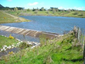
The hundred million dollar question is “Will the Waimea Dam hold water or have we built a $200 million bridge?”

dam or bridge

In the December 2022 update Mike Scott CEO of Waimea Water, the dam construction company, tells us that we are still on budget but the budget is being stressed by various items such as the cost of the Mechanical & Engineering components that were never designed or priced in the original quote. Makes you wonder how we ever had a “P95” guarantee doesn’t it?

However, this has also been the story told to Council in the past. We are on budget but there are pressures. Nek Minnut a $30 million blow out. Never saw that coming! Not the first time, not the second time, not the third time. And yet here we are $195 million versus the P95 price of $76 million.

The dam is now about 84% complete as compared to the 75% complete at the last two updates. Because it 75% complete in the first update early in 2022 and then again 75% complete in the mid year update we discovered that the update percentage figure is tagged to the timeline and not the amount of work done. So, because the completion timeline was pushed out in the midyear update the percentage completed remained the same. We have now revisited the practical completion date, bringing it forward some months so the percentage completed jumps up accordingly. Who knows what percentage of the actual work has been completed between updates because we don’t measure that metric apparently.

What is more pertinent to the question that we should all be wanting an answer to (Will it hold water?) was Mr Bedrock-everywhere Scott’s comments around the grouting. Of course, most of the Councillors had no concerns at all in this regard, and were busy patting themselves and others on the back for doing such a great job to get this far.

Will all this work be in vain?

In answer to Councillor Walker’s question Mr Scott explains that the grout curtain seals substrata and stops leakage under the dam. It is a process where we drill 44 meters down into the substrata and pump concrete into the holes sealing up all the leaks. We budgeted for 5000 meters of drilling and now have completed 17000 meters of drilling which is much more than originally budgeted.

When Councillor Walker asked for clarification that they are drilling down to bedrock Mr Scott replied “No.” When then asked how far they drill he responds.”it is through the rock, all rock has permeability. The deeper you go down the longer the path so there is less flow so the grout curtain is deepest at the deepest part of the reservoir and it is through rock sealing up .. sealing .. or reducing the permeability of the rock.”

Councillor Greening followed up Councillor Walker’s questions with “In the past when you have spoken about grouting you have explained it in terms of drilling down to bedrock. Have we drilled down to bedrock given that was best practice or have we not drilled to bedrock and stopped at 44 meters?”

Mr Scott responded “Drilled through bedrock The dam is built on rock, we have cleared the overburden and got down to sufficiently strong bedrock to found the dam, drilled down through the bedr… through the rock up to 44 meters deep to reduce the permeability of that rock.”

Again, Councillor Greening sought clarification “we have got grout holes drilled down to bedrock and through bedrock is what you are saying?”)” And got the response “Through the rock that is right.”

One more attempt from Councillor Greening for a direct answer “through bedrock? draws yet another blank with Scott’s “yeah through yeah through founding rock” answer.

So what did we learn from that exchange? We learned that their initial site investigative work suggested that they would need to drill 5000 meters of grout holes. Once they started they decided that they needed to drill 17000 meters (up to 44 meters deep) of grouting. What we weren’t told is whether they believe they have now sealed the reservoir or whether they stopped due to budget or other constraints (such as still no sign of solid rock at 44 meters).

Mr Scott’s dancing around the answer of are they in solid bedrock with yes bedrock/rock/all rock is permeable/founding rock could be a confirmation of the word on the street that some of the holes were seemingly bottomless soft rock/clay. Possibly the result of building a dam on a fault line – sorry, according to Mr Kirby Council Head Engineer it is just a convergence of “shear zones” running through the dam site.

The stumbling Mr Scott did around the grouting “sealing up .. sealing … or reducing the permeability” also suggest that he was reluctant to say that the grouting to date was a success at sealing the reservoir floor, or sealing it sufficiently that we have a dam and not a bridge.

(sorry mostly sound .. skip to 40 seconds to hear start)

One thing is very clear, and that is that the initial dam site examination was woefully inadequate. If we examine Mr Scott’s comments in light of studies about dams we find that not only was the site selection particularly bad, but the investigation into the site was woeful, and now there questions over the construction process. But don’t take my word for it, lets have a look at some instances.

Our findings show that bedrock permeability is a higher-order control on flow path distribution across catchment scales, and hence on MTT scaling relationships. This is particularly significant as more and more researchers are finding that bedrock groundwater makes significant contributions to streamflow in catchments where the bedrock was previously thought to be impermeable [Gabrielli et al., 2012].
Source

This extract highlights that even “bedrock” can be more permeable than first thought, agreeing with Scott’s assertion that all rock is permeable. However, as he was reluctant to be committed to the term “bedrock” we are left questioning what kind of rock the dam is built on and where exactly it sits on the scale of permeability.

There are two main types of porosity: intergranular porosity that characterizes sands, gravels and mud, and fracture porosity in hard rock. Fracture porosity forms during brittle failure of hard rock or cooling of lava flows. Fracture networks that are connected can provide pathways for fluid flow even when the host rock is impervious (e.g. granite, basalt, indurated sandstone). Highly productive aquifers are not uncommon in fractured bedrock.
Source

Here we discover that “highly productive aquifers are not uncommon in fractured bedrock.” One would be “very surprised” to learn that there are highly productive aquifers under a dam site located between to major fault lines and sitting on yet another convergence of sheer zones! Doesn’t sound like a place you find fractured bedrock at best to me.

Fracturing of the rock commonly accompanies faulting, and a fault may be marked by a zone of fracturing rather than by a single fracture. Faults and the fracturing that accompanies them also afford avenues by which surface weathering and solution activity can attack the rock. Fault zones present a possible escape route for the reservoir water, and faults also indicate, in varying degree, the hazard of continued or repeated movement.Faults in the foundation and abutment rocks at a dam site and in a reservoir area introduce problems of bearing strength, stability, and water-tightness and, therefore, sites that contain them should be avoided. Stable dams can be designed for faulted foundations, but the cost of the necessary remedial treatment may be prohibitive.
Source

“Sites that should be avoided” if this was a dictionary entry I would suggest that the Waimea Irrigation Dam site would be the explanation following it. Not only can we expect a leaky reservoir, we can expect that there is likely to be further movements adding to our woes for years to come (should the dam be completed) and of course the remedial work might be prohibitive were it not for the fact that there is no off-ramp for this council. We must have the Kempthorne/King/Bryant/Mailing memorial no matter what.

Conclusions Monitoring of seismic activity
• Prior to construction,
• During impounding of reservoir, and
• During first years of reservoir operation is highly recommended for (i) large storage dams, and (ii) dams located in tectonically stressed regions.
Source

I found this comment particularly chilling. I don’t think there is any dispute that we have a dam located in a tectonically stressed region (in fact I would suggest we are right on top of a fault line), so have we been monitoring seismic activity at the dam site before, during, and looking ahead into the future?
As the article goes on to explain below, the pressure exerted by the reservoir water has the potential to create seismic events, especially in a site already loaded with shear zones and weak rock. This is important because any failure of the grout curtain, assuming it works in the first instance, could well see a failure of the dam by way of erosion of the foundation. I mean what are the chances of an earthquake cracking an unreinforced concrete grout curtain places on a fault line?

The statistics of dam failures performed by ICOLD [8] takes into account dams 15 m high or more or with a storage volume of at least 1 million of cubic metres. The results of this work can be summarized as follows (data from China and the URSS were not considered): the most common type of failure in earth and rockfill dams is overtopping (31% as a primary cause, 18% as a secondary cause), followed by internal erosion of the body (15% as a primary cause, 13% as a secondary cause), and in the foundation (12% as a primary cause, 5% as a secondary cause) ,,,
Failures leading to catastrophic consequences occur typically at first filling and full reservoir stage, although overtopping during construction has caused, in some cases (for example Panshet dam in India, Sempor dam in Indonesia and S. Tomas dam in Philippines), several victims.

A dam [38] radically alters the natural antecedent state of stress in the valley flanks and river channel; it adds weight, a more or less concentrated vertical load resulting in a complex compression and shear forces in the foundation. It transmits forces caused by loading during its operational life (water load, temperature effects, etc.). These forces produce compression, shear and often upstream tensile stresses. Water seeps into pores and rock discontinuities of the foundation; seepage forces can be considerably high and act in extremely unfavourable direction for stability of dams. The main steps of stability analysis of such a complex structure made up of rock mass and concrete structure consists of the definition of the possible modes of failure and calculation of the equilibrium conditions for stability. Geological and rock mechanical studies are required to evaluate the possible modes of failure and the variables of the problems. Analytical or numerical methods are used to assess dam foundation stability conditions.
4.1 Geological and rock mechanics studies
Geological studies with field explorations help to determine the feasibility of a dam and decide the general layout of the works including dam type and position. The first geological work [38] is to outline the regional and thereby the site structure, then the genesis and history of rocks and hence their stratigraphic, petrographic and tectonic descriptions which indicate the type of the problem to be expected. High-scale hydrographic and hydrogeological studies are required since a dam construction determines the presence of a new water reservoir which changes the original superficial and underground water flow. The principal purpose of rock mechanics studies is the characterization of the rock mass hosting the dam in order to assess deformation and strength features and to evaluate the geometrical and physical properties of singular and systematic rock discontinuities.

Filed Under: Dam, Your Say Tagged With: dam overruns, Waimea Community Dam, Waimea dam

Dam Jumble Of Geology

04/04/2020

[This is a purely fictitious tale, any resemblance to fact or persons alive or dead is totally coincidental.]

As news of yet another Dam blowout reverberates around the district there appears to be more than crumbling rock at the heart of it. Signs are also evident of crumbling relationships as fingers are pointed at who should carry the cost.

Mike (we are on bedrock) Scott, the CEO of Waimea Water (a Council Controlled Company), referred to the unsuitable rock as an “unforeseen” geological condition.

non-homogenous, complex “almost a jumble of geology

REACTED CONTENT

In the Full Council agenda for the 26th of March 2020 (the meeting that never happened because of Covid-19 lock down) the two TDC staff outline the history of dam design and contractor involvement up to the current situation. Much of the detail being revealed to Councillor’s for the first time and interesting reading if you have not read it yet.

In the report they reference the work done by Tonkin and Taylor (T&T) in research and preliminary design before Waimea Water hired Dam Watch to replace T&T. The T&T reports seem to suggest that the geology of the Dam site might present some challenges, and that some of the rock might not be suitable in the various construction stages.

Of course, placing a dam between two known fault lines might be considered a bit of a red flag to most people. It certainly raised some concerns when TDC consulted on the Dam in late 2017. However, people had been raising the issue for some time prior to that. Trevor Riley, for example, had been trying to get someone to listen to his concerns about the maps used in the Dam consent application and how they appeared to show a deliberate attempt at hiding information. The maps submitted were from a digital source that had apparently had layers of data switched off before printing.

Who is to blame and how much it will cost the rate-payers of Tasman is yet to be revealed. It will set the stage for the next round of blow outs – remember we are still only half way through the dig out, and now we have COVID-19 delays to attribute the costs of as well.

Since I am currently locked down on house arrest to save the world from COVID-19 I thought I would have a look at some of the media reports around the Waimea Dam and establish a public timeline of events. More revealing than the vanilla minutes published from TDC’s perspective of what occurs in meetings. So if you have the time for a quick skim, carry on reading (what else do you have to do?).

Aug 25 2015  Paul MacLennan sums up the process from his perspective

The current Gold Plated Rolls Royce proposal being pushed by the Mayor, Deputy Mayor, and about 25 high water abstracting irrigators seems to be a blatant attempt to get ratepayers to subsidise their water, underwrite the project risk and gain access to “Requiring Authority” powers for the dam beneficiaries.

Jan 15 2016 Costs start to climb, but we now have a certain price – the “it can’t possibly go over $83 million because we have a P95”!

However, the total required is disputed. The council’s $83m figure is based on a risk factor which assumes there is a 95 per cent probability the dam can be built for that amount of money or less. It’s known as P95.

WCD project manager Nick Patterson said the dam can be built for $73m, including the $6.5m already spent. This was using a P50 risk factor that assumed the dam could be built for that amount of money or less.

Jan 21 2016 People are suggesting that this dam is unaffordable.

Few irrigators on the Waimea Plains could afford the proposed dam, says Waimea Irrigators and Water Users Inc consultant Brian Halstead.

Waimea Irrigators and Water Users Inc has about 30 members. They are smaller irrigators who believe “the dam is too big and will cost too much“.

Oct 04 2016 Assurances are given that letting water run out to sea from the dam will recharge the aquifers as promised. Although, when questioned the TDC experts were unable to give a figure as to how much released water would travel from the river into the aquifers. A minor detail that is only important if you believe salt intrusion into aquifers is a problem we are trying to solve.

“The council can be satisfied that the hydrometric modelling on which the Waimea water augmentation scheme is based is ‘fit for purpose’,” McKenzie says in his report. “The water management aims that the council and community have agreed will be achieved.”

May 04 2017 The importance of having a firm quoted price established before we go out to consultation is stressed. Unfortunately, not delivered on. And an explanation as to why the Fresh Water Improvement Fund grant should go toward covering the Irrigator’s use of the river as a conduit and not the rate-payer’s at large.

TDC is planning to consult with the community later this year before it makes a final decision on the project but wanted a build price for the dam before that public consultation. 

When the invitation went out to potential dam builders in April, TDC chief executive Lindsay McKenzie said the total project budget would be a key factor for people to assess the merit of the proposal. “It’s important for us to have an agreed price for building the Waimea Community Dam before we ask our community for feedback on the overall package,” McKenzie said. 

TDC has previously agreed to fund two-thirds of the environmental flow component, leaving one-third unfunded.

When asked whether any money received from the Freshwater Improvement Fund should be put towards TDC’s share of the environmental flow component, McKenzie said that was “not the basis on which the application has been made”.

“Some councillors have argued it should come off the council’s contribution,” he said. “But the challenge is bridging the capital funding gap.”

Jun 03 2017 Warnings of increased annual running costs for the rate-payer.

Tasman district councillors will be asked if they want to stay around the negotiating table for the proposed Waimea dam as estimated operational costs are expected to rise.

Mayor Richard Kempthorne said an original estimate of about $700,000 a year was based on the operational costs for the Wai-iti Valley Community Dam “and scaled up”.

However, the “actual” operational costs for the proposed dam in the Lee Valley were being “worked up” and looked likely to be higher.

Jun 08 2017 Irrigators cry poverty. However, John Palmer believes he will get costs down.

Annual operational costs for the proposed Waimea dam are tipped to be more than $600 a hectare for affiliated irrigators on the Waimea Plains.

That’s a rise from an estimated $500 to $550 per hectare for the initial year of operations contained in the Shareholder Information Document and Survey, dated January 2017, from dam proponent Waimea Irrigators Ltd (WIL).

“They are very concerned about that,” Palmer said. “A number above $600 makes it pretty challenging. It’s got to work economically; we’ve got to get a number that works for the vast majority of landowners.”

He said he believed the dam company could be a “very efficient organisation” and there was an “opportunity in the future to get those costs down”.

Jun 13 2017 Rate-payers should be equally concerned about the massive blow out of running costs. Remember, operating costs will continue every year for the life of the dam. We also see more costs being shifted from irrigators to rate-payers.

If the councillors agree to the draft resolution, TDC will face an expected increased capital contribution of up to $3m along with a massive hike in operating costs – up an estimated $460,000 to $675,000 a year.

Ratepayers may also face rates rises higher than a 3 per cent annual limit set in the council’s Financial Strategy and some other capital projects may be “reprioritised”.

A report by TDC chief executive Lindsay McKenzie shows the forecast operating costs have risen from an expected $700,000 to $750,000 a year to $1.3m to $1.4m per annum after “a more complete analysis”.  

Under the revised allocation proposal, the council’s contribution to operating costs climbs from 18 per cent to 52 per cent, with irrigators providing the other 48 per cent. Irrigators had been due to meet 75 per cent of the operating costs under an earlier model with TDC covering 18 per cent and Nelson City Council the remaining 7 per cent.

In his report, McKenzie says WIL is “at (or near) the limit of their ability to pay” and the proposal hangs “in the balance”.

“Unless the council steps up and carries more cost and provides strong credit support, the project is over,” he says.

TDC corporate services manager Mike Drummond said the estimate of the total project cost remained at $82.5m, including $13m as a contingency allowance. 

Capital costs were being reviewed. If they were to go up, the “ballpark” figure was a rise of about $3m.

“It’s not going to be a major blowout in costs, just a re-evaluation of the costs to complete the project,” Drummond said.

The finance boss confirmed an increase of $3m, added to $25m in the Long Term Plan and $3m as the council’s share in sunk costs before 2015 would lift  its total to $31m. He also confirmed the proposed operating costs of up to $675,000 a year would be ongoing for the council.

Waimea Irrigators and Water Users Society consultant Brian Halstead said irrigators would still face big costs, even if councillors agreed TDC would provide additional funding.

Along with an expected initial capital contribution of $5100 per hectare/share to affiliate to the dam, irrigators faced the prospect of having to pay back the $25m loan from Crown Irrigation Investments. Based on interest of 2.8 per cent, Halstead said it would cost irrigators about $700 per hectare a year over the 15-year term to pay back the principal and interest for the proposed loan. Irrigators would also face a share of operating costs.

“It’s too big,” Halstead said.

Jun 15 2017 Kempthorne casting vote loads up the ratepayer with massive hike in ongoing costs plus extra capital costs.

Tasman Mayor Richard Kempthorne has used his casting vote to push through a resolution that increases ratepayers’ share of costs for the proposed Waimea dam.

The resolution also opens the door for Tasman District Council to underwrite a proposed $25 million loan from Crown Irrigation Investments Ltd that is tipped to make up a big chunk of irrigators’ portion of capital contributions to the dam, which has an estimated total project cost of $82.5m.

The resolution passed on Wednesday means TDC now faces an expected increased capital contribution of up to $3m along with a massive hike in operating costs – up an estimated $460,000 to $675,000 a year.

Cr Dean McNamara said he did not believe any councillors were against the dam but were against overcommitting the council at this stage of negotiations, with the quote and construction stages still to come.

Jul 12 2017 Smith begins bullying people who are not supporting the dam.

“The Greens’ criticism is ill-informed, shows they haven’t done any homework on the specifics of the proposal and have just reverted to their anti-agriculture, anti-infrastructure rhetoric,” Smith said. “The claim by Mr Lawrey that the dam will increase nitrates in the catchment is just plain wrong. He seems ignorant of the fact that irrigated apples produce fewer nitrates than the existing dryland farming. He also overlooks that the dam will enable substantial increases in minimum flows and the potential for fresh flows in summer to eliminate the algae that currently causes problems.”

Conveniently, Smith seems ignorant of the fact that there are significant market gardeners on the plains who are not so frugal with nitrate use.

Smith said he was “dumbfounded” by Fulton’s comments about residential development.

“New homes need water whether they are apartments or greenfield 800 square meter sections,” Smith said. “We must ensure more houses are built if we are to avoid unaffordable house prices and rents.”

Smith is again telling half a story. The bulk of our housing development in Tasman is on greenfield development – which is horticultural land. Houses use only one third the water of horticulture so the more houses we build the less water we use.

Jul 14 2017 Palmer continues to sell his over-sized dam despite the numbers not stacking up. But then what has he got to lose as the costs have been shifted to the ratepayer.

Fraser said he believed “the fundamental problem” with the proposed Waimea dam was that it was “the wrong size”.

“It’s too big for the area to be irrigated yet too small – given dams are subject to scale economies – to be a viable project,” he said. “The result is the water is too expensive and no-one can afford to buy it.”

However, Palmer said the dam was being built with extra capacity as an investment for the future, which made “perfect economic sense“.

Sep 11 2017 Kemthorne reveals his complete ignorance of both construction and business accumin – or is it motive?

Tasman District Council will pump $26.8 million into the Waimea dam project, underwrite a further $29m and face the cost alone of any overruns above $3m, under a new funding and governance proposal for the controversial scheme. 

Mayor Richard Kempthorne described the new plan as the “best combination” the council was going to get.

While there was a $29m underwriting provision in the new model, the irrigators would bear that cost, the mayor said, adding that he believed the likelihood of the underwrite being called in was “extremely low”. It would mean the financial reality had turned to “chaos” on the Waimea Plains, he said.

Welcome to COVID-19. Although horticulture industry collapse has happened before and is always susceptible to weather, disease, pestilence, and overseas market challenges.

The new model has the council taking over the funding for 425 hectare equivalents of unsubscribed capacity in the dam that was appointed to WIL under the earlier model. 

Kempthorne said under that earlier model, WIL had reached the “limit of what it could fund”. The additional unsubscribed capacity also gave the council “long-term security of supply” for the growing urban areas, he said.

Actually, the extra capacity does not give Council any more resilience than it would have with only one share if you understand that all the water runs out to sea and nobody has an “allocation” of stored water. This was just moving more cost away from irrigators and onto general rate-payers.

Under the new funding proposal, the council and WIL are expected to share equally the burden of any cost overruns up to $3m but in the “unlikely event” of an overshoot above $3m, the council will meet those costs alone.

Kempthorne said the dam costing was based on a “P95” confidence level, which meant the council could have 95 per cent confidence the dam would be constructed at or below the estimated cost of about $50m, which includes $13.5m for changes in scope and unexpected costs.

“There’s not much chance it’s going to be over,” Kempthorne said.

Effectively, he is saying that this is the first large scale dam in the history of the world that will be built on time and under budget. That is the $83 million dollar budget. Sounds like an iron-clad guarantee?

Meanwhile, engineering services manager Richard Kirby told councillors the detailed design and final cost of the dam would not known until March or April, after the likely public consultation.

Nevermind the warning of CEO McKenzie that we would need a price before we consulted. With the huge number of irregularities during the process it is not surprising that he took early retirement. A common theme as Waimea Water Chair Karen Jordan announced an early departure just before the costs blew out hugely for the second time.

Oct 18 2017 Council pre-allocates future income from the commercial account for the next 10 years. Not only was this a grossly abhorrent imposition on future councils, it also puts the rate-payer at great risk of picking up even more costs as we face next to no commercial revenue in a post COVID-19 world.

The council’s expected share of capital costs totals $26.78m. Under its proposed funding option, $12.91m would come from commercial returns and surpluses; the other $13.87m from water rates and charges along with targeted rates to repay 30-year table loans.

Of that $13.87m, it’s proposed members of the council’s urban water club pay $9.58m via a hike of about 10 per cent in the fixed water rate and volumetric charges. Based on a average use of 225 cubic metres of water per property annually, that equals about $76 a year.

The $12.91m portion of expected council capital costs earmarked to come from commercial activity dividends and surpluses covers repayment of a likely $10m interest-free loan from CIIL along with $2.91m for a share of unsubscribed capacity in the dam.

Oct 31 2017 Numbers still not viable for Waimea Dam

It was irrelevant whether he liked the project, Fraser said, adding that he applied tools to determine if projects stacked up. “This one doesn’t stack up.”

Fraser said, in his view, the fundamental problem in the Waimea catchment was overallocation – an excess demand for water.

“The proposal we’ve got from the TDC is to solve an excess demand problem with an excess supply solution,” he said. “A much more sensible thing to do is sort out the excess demand rather than permitting and enhancing the excess demand.” 

Fraser said the proposed Lee Valley dam was too big for the area to be irrigated but too small to be a viable irrigation storage scheme.

“There is way too much water for what you actually need.”

Another problem was the estimated $82.5m cost.
“Put a 10 per cent contingency on that – I think, that’s probably pretty conservative,” Fraser said. “Let’s be honest, it’s $100m by the time the ink’s dry.“

“It’s just too expensive.”

Frazer was right on both counts. Ink dried on $105 million dam – now an eye-watering $130 million with the surface barely scratched.

Nov 12 2018 Irrigator poverty a misrepresentation.

The basis for some of the key decisions on the controversial Waimea dam project has been called into question.

Tasman district councillor Dana Wensley on Thursday told her fellow elected representatives that some “crucial” council decisions had been based on a claim that Waimea Irrigators Ltd – TDC’s joint-venture partner in the project – had reached its “limit to pay”.

However, Waimea Irrigators Ltd (WIL) had since “openly and publicly” declared it had another $11.5 million.

Nov 13 2017 Hydrology reafirmed – although they still cannot give figures of aquifer recharge from the river. Time will reveal all.

The debate over the hydrology behind the project has a long history. Fenemor was part of a 2016 peer review of the hydrological science underpinning the design and operation of the proposed dam that found it was “fit for purpose”.

Nov 28 2017 Dam “very unlikely” to collapse – dam also very unlikely to exceed $83 million according to the same expert.

It is “very unlikely” the proposed Waimea dam will collapse in a severe earthquake, Tasman District Council engineering services manager Richard Kirby says.

Johnston said the hazards facing the dam site had been identified including that it sat between the Waimea-Flaxmore Fault System and the Wairau Fault, which is a section of the Alpine Fault.

Concerns have been raised by some people that the updated report did not consider vertical motions, which were a feature of the Kaikōura and Canterbury earthquakes.

Johnston said he did not believe vertical motions needed to be part of the updated study.

Dec 13 2017 Consultation reveals public concerns. Concerns that would later return to catch experts “blindsided.”

Chartered public sector accountant Louise Coleman said the process followed by the council in the past year and some of the information provided was “shockingly poor”.

“Just about everything TDC has done, which I’ve looked at, is lacking in one respect or another,” Coleman said.

Coleman said she did not think the funding model stacked up and the potential effect on the region’s economy under a no-dam scenario had been “misrepresented”. The loss to production if the dam was not built was just 0.4 per cent of annual regional GDP and Tasman district would have a healthy growth rate without it, she said.

Figures from the 2019 severe drought year would suggest that the region did not suffer economic collapse.

Tony Lawton said the funding proposal was a bad deal for ratepayers while Dr Roland Toder said the cost estimates were “quite vague”.

Toder referred to a 2014 Oxford University study on large dams that he said found actual costs were 96 per cent higher than the estimate on average.

“To me, the dam is $160m if we’re lucky.“

Richard Kirby and John Palmer, are still insisting that the Dam will not exceed $83 million at this point. Who is more qualified to manage projects?

Franca Moranui said she believed people “clearly said they did not want a dam” during public consultation in 2014.

“Now, it’s … been rehashed and thrown at us again,” Moranui said. “Whose interest is TDC taking care of if they’re not listening to what the people want.”

Cr Trevor Tuffnell said there were “quite a few” people who did want the dam.
“How many,” Moranui asked to which Tuffnell said he did not have the numbers.

Which is why Cr Tuffnell voted against a referendum twice?

Federated Farmers Golden Bay president Wayne Langford said his organisation generally supported the proposal but did have some concerns including the underwriting risk and a plan to use revenue and surpluses from the council’s commercial activities to repay some of the dam cost.

That funding would be used to offset rates or for other council expenditure and should be considered a further ratepayer cost, Langford said.

It will definitely be a further ratepayer cost if we do not continue to generate significant forestry revenue.

Motueka Community Board member and former councillor Barry Dowler, speaking as a ratepayer, said the proposed $29 district-wide cost was not expensive.

Pertinent comment with a by-election in progress?

John Clifton said the process was not democratic and there needed to be a referendum.

As many submitters pointed out over the four days, the question of whether or not there should be a dam was not on the council submission form. Therefore, it is hard to be definitive about how many submitters were in favour, or against, the proposal.

However, an analysis by the council of the responses to the five questions on its form from 777 submitters, whose submissions were received by deadline, provides some insight. For four of the five questions “none of the above” was provided as an option and in each case, it was the most popular choice.

For two questions, “none of the above” received twice as many nods as the next highest preference. In response to a question asking which option submitters supported for funding the council’s share of the urban water supply, 426 submissions had “none of the above” ticked – 216 more than the next highest choice.

In response to the question on which option for credit support was backed, 479 submissions had “none of the above” marked compared with 223 for the proposed option of full support by the council.

A Water Information Network (WIN) analysis of 607 submissions provided on a form distributed by WIN shows a majority of 518 answered “No” to the question: “Is the dam the best option”.

Perhaps that is why some Councillors and a casting vote mayor were so desperate to avoid a referendum. Because they knew “many people” supported the dam.

Dec 15 2017 David Easton will cease apple growing without a dam. David Easton sold up his orchard before the ink was dry on the dam. No prizes for guessing why he was such a vocal supporter of the dam. How much capital gain did you make David?

Orchardist David Easton warns apple growing may go from the Waimea Plains, near Nelson, if a proposed $82.5 million dam doesn’t get the nod.

“Without the dam proceeding, we do not have a viable option other than to cease apple growing,” Easton said on Friday during a hearing at Motueka. “What are the consequences of that to all our ratepayers in the Tasman district?”

Dec 27 2017 A clear warning from a dam building expert (one who offered TDC his services to review the project but was declined).

Water resource engineer Dr Mike Harvey says the proposed Waimea dam is a high-risk project.

“My biggest concern with the Waimea dam project: I don’t believe that the costs have been really worked out for this dam,” he said. “As a ratepayer, I’m concerned about that … because it’s under designed, it’s under costed.”

Harvey has a home at Mariri, near Motueka, but a lot of his work has been carried out in the United States – much of it in connection with dam projects.

From his Mariri property, Harvey said he had just been working on two US dam projects: A proposed hydroelectric dam in Alaska and a planned dam to provide urban water for the expanding Dallas metropolitan area of Texas.
“I’m not anti-dam.”

Harvey said his speciality was rivers and his role for the US projects had focused on sedimentation including the likely effects of the absence of sedimentation on the rivers below the proposed dams.

This is another problem that TDC staff deny will be an issue. I hope the gravel extractors have faith in TDC staff.

He also had experience with tailings dams for mine operations and in every project he had worked on, the final cost “way exceeded” the initial estimate, he said.

That unknown final cost was his biggest concern with the Waimea dam project, along with a suggested funding model, that has ratepayers responsible for a 50 per cent share of the first $3 million of any cost overruns before picking up the tab alone for any budget overshoots above that.

Any rational rate-payer would have grave concerns with that deal.

“Everything I read about the geology and seismology says to me it’s very complicated.

“I see numbers in there that don’t reflect the seismic reality. I would be very loath to build a dam in that location.”

Harvey said concerns about seismic risk including potential vertical motions were “eminently addressable”.

“I don’t believe anyone wouldn’t take these factors into consideration but what’s the cost,” he said. “The irrigators’ costs have been capped; everything else is for the ratepayers.”

If an earthquake did affect the Waimea dam, it might not fail catastrophically “but you’ve got a broken dam and a broken dam is not any good to anyone”.

Harvey said the available design information he’d seen indicated the dam would have limited outlet capacity and he estimated it could take a week or 10 days to drain the water if it was damaged.

He doubted a ruptured dam would be repaired and wondered if the likely cost of decommissioning the structure had been considered.
“Taking dams out is also extremely expensive.”

Something else I fought to have included in the Term Sheets but it was rejected by those who supported the dam. Why would that be, and who were they more interested in protecting?

There was always upward pressure on the cost. “Until you start excavating, you really don’t know what you’re going to get.”

Harvey said the proposal “confounds me in many ways” because there was no constant need for the water.

“The goofiness about the project is it’s not designed to be used all the time; it’s sort of an insurance policy, a top-up.”

Harvey said he got all of the water for his rural property from the roofs of his buildings.

“How much of the urban demand could be satisfied by a joint roof-top [collection] and council top-up supply?”

Harvey said he grew up in Christchurch. He had bachelor and masters degrees in agricultural science from Lincoln and a PhD in water resources form Colorado State University.

Feb 09 2018 More cost creep coming in the backdoor.

The long-awaited launch of the Waimea Irrigators Ltd prospectus for the proposed Waimea dam has come with a $5.7 million hike in the estimated capital cost of the project.

The capital cost for the dam still to be funded is listed as $81.6m in the WIL product disclosure statement, which is $5.7m higher than the $75.9m estimate used in earlier dam documentation including the council’s statement of proposal that it put out for public consultation in October.

On the higher estimate, WIL project manager Natasha Berkett said the revised budget included actual costs that had been incurred, “tested estimates” and revised modelling.

“The result is an updated project budget of $81.6m.” Berkett said, adding the revised budget included $13.5m for construction contingency costs.

May 25 2018 Waste of money

A referendum on the proposed Waimea dam came tantalisingly close twice on Thursday before it was crushed by Tasman mayor Richard Kempthorne wielding his casting vote.

McNamara then moved the draft resolution for a non-binding resolution and the vote went the same way.

Before the vote, Sangster suggested a non-binding referendum would be a waste of money. “At the end of the day, we’re going to spend $80,000 to do what? We’ve still got to make the decision,” he said. “It’s still going to be 7:7. Hell, I can bet on that.”

McNamara said he was bemused by people talking about cost because the council had agreed to spend the same amount for temporary seating. He was referring to a council decision in October to approve an $80,000 contribution towards the seating for the planned All Blacks test match at Nelson in September. That approval came after Kempthorne again used his casting vote, this time for the motion.

“What’s more important to the future of this district – two hours of temporary seating or a dam that’s going to affect rates for the next 10 years at least,” McNamara said.

May 28 2018 More procedural irregularities.

Former council chief executive Lindsay McKenzie last week told councillors that consultation needed to occur before the bill was introduced to the House.

“Assuming that you gave us the mandate to proceed with this work and we can get a report back onto your 28 June agenda, we can commence the process of giving public notice on about July 4,” McKenzie said. “The bill could be introduced into the House in about the third week of August.”

Jul 03 2018 TDC Governance not allowed to know details of deals the staff are signing us up for.

Tasman District Council corporate services manager Mike Drummond intends to seek legal advice on whether he can release dam-related documents to councillors.

Before the motion was put, Drummond said he believed CIIL would want “significant portions redacted and I would have to take legal advice to see if I could release them without breaching the agreements and opening council to legal challenge”.

Jul 05 2018 Completely blindsided – if you ignore all the people who were telling you the figures were a joke.

Tasman mayor Richard Kempthorne on Thursday said the price to build the proposed concrete-faced rockfill dam in the Lee Valley was “higher than expected” and indications were there would be “significant challenges” to remain within the estimated cost.

“If the final price is confirmed to be significantly over the estimated cost and no viable option can be found to meet the difference, then the dam is unlikely to go ahead,” Kempthorne said.

When pressed to provide that early pricing or an indication of how much it was above the estimate, Kempthorne repeated that he did not know nor did he want to know.

The Mayor doesn’t want to know how much the biggest project in TDC history is coming in over budget. Because he is building a monument no matter how much it costs the rate-payers?

Cr Dean McNamara said councillors were told about the matter shortly before the media release was issued but were not provided with the early pricing. The Moutere-Waimea Ward councillor said he asked for a range to indicate how far out it might be from the budget. It was not provided.

“I think, like every ratepayer in Tasman – apart from the mayor – I’d like to know,” he said. “How can I rely on information going forward if they bring the price within scope? What corners will they cut to get it there?”

Kirby admitted he knew the figures but declined to be drawn on them.

Again, there appears to be some confusion as to who is Governance at TDC.

Jul 19 2018 Solid Energy anyone?

WIL strategic adviser John Palmer said when the project was assessed in 2015, it was on the basis of an 80 percent dam design.

“My assessment, having inherited those numbers, on the basis of what we see now is that … I don’t think it was anywhere near 80 percent complete either in cost or complexity in relation to the numbers we’ve got today.”

Palmer said he was “completely blindsided” by the updated figures.

“There has been no indication during the work of the project office, until the prices were released, that a number of this order should be expected.”

When the man in charge of the dam office is blaming someone else that says a lot about character and competency.

Jul 21 2018 A project with no contingency for exiting.

Tasman District Council is being urged to step back from the controversial Waimea dam project.

Amid news of a 35 per cent escalation in costs, adding an expected $26 million to the bottom line, there have been multiple calls for the council to stop spending money on the project.

“I think, it’s buggered,” economist Peter Fraser said. “How bad does it have to get before [the council] takes the off ramp?”

Every off ramp was passed. It looked very much like conflicts of interest should have been declared.

Palmer said inflation adjustment was included in the revised number but it was not a capped price.

“If we had been seeking a fixed capped price, the number would have been higher again,” he said.

REACTED CONTENT

Aug 15 2018 Shane Jones play’s God

The outspoken minister has called on the Tasman District Council and economic stakeholders in the proposed dam to “step up to the plate”  if they want the Government’s Provincial Growth Fund to help plug a $26 million funding hole.

His statement adds to the pressure on district councillors who are expected to decide on the dam’s future on August 28.

Jones took a swipe at dam opponents, saying the “bellyachers need to come out from under their ideological foliage” and acknowledge that the region faced some large and costly challenges over water quality and security.

Aug 29 2018 The Mayor goes against a Council resolution and carries on with the Dam regardless.

Tasman mayor Richard Kempthorne has no plans to resign in the wake of a council decision that effectively ends the Waimea dam project.

However, he suggested that a dam in the Lee Valley, near Nelson, may not be completely dead in the water.

“We’ll still do everything we can to see if we can make it work,” Kempthorne said. “All options are on the table to see where to from here.”

A complete disregard for protocol typifies the Kempthorne dynasty – in my view.

Irrigation New Zealand chief executive Andrew Curtis said he was “somewhat shocked” by the council decision.

“After years and years of investment and millions and millions of dollars to establish the Waimea dam as the way forward, I’m really struggling as to how they came to the conclusions they did.”

Curtis said it showed the need for “some more significant infrastructure projects to be raised up to a higher level,” and mentioned the planned reform of the three water services – drinking water, stormwater and wastewater – including the potential aggregation of local government water functions.

“We’ve got to take it out of the three-year electoral cycle,” he said.

Now is your opportunity. Go ahead and build a dam in conjunction with the broke irrigators and leave the ratepayer out of it. We could join Nelson City with a $5 million donation.

Aug 30 2018 The Waimea Dam is unaffordable as is obvious to anyone that runs the numbers. To go ahead would be to risk bankruptcy for either Tasman District Council or many of its ratepayers.

McNamara and some other councillors also raised concern at a provision for the council to face the cost alone of any cost overruns above $3m.

It meant capital contributions were capped for WIL but not for the council, McNamara said.

“As the costs blew out, the broken funding model just became unmanageable for ratepayers who have some of the highest general rates and the highest urban water rates in the country,” he said.

Not to mention that irrigators with a capped contribution are in charge of the dam office and Councillors are repeatedly shut out from receiving the facts.

Aug 29 2018 Dr Williams was introduced by former CEO Lindsay McKenzie to the Council as head of an independent water research group. He was also officially invited to attend community consultations to give independent advice. You can imagine our surprise to see him handing out VOTE FOR THE DAM buttons and banners pre the Council vote on the dam.

Before the meeting started, supporters of the project stood outside the council offices with placards and “Yes” badges. Among them was former former Parliamentary Commissioner for the Environment Dr Morgan Williams who said he had never been involved in community action previously.

Williams said he had stepped up this time after having looked at the dam project with his investigatory and statutory “past hat on”.

“This one stacks up,” he said.

Quite by chance Dr Williams was awarded a medal for services rendered soon after. It would be interesting to see the figures that Dr Williams cast his expert eye over to figure that “this one stacks up.”

Long-time orchardist David Easton was also out to show his support of the project.

Minimum flow requirements for the Waimea River meant the status quo with water use could not remain.

“People naively think we can actually continue as we are,” Easton said.

People gullibly thought Easton was interested in the future of horticulture in Tasman.

Sep 06 2018 Jones says base your decision on facts.

Regional Economic Development Minister Shane Jones, who has waded into debate around the project, would not be drawn on whether the council should be discussing such an important issue behind closed doors.

Regional Economic Development Minister Shane Jones says he hopes Tasman district councillors will make a decision on the dam based on facts and science.

He said he had taken some stick over his colourful comments about opponents of the dam but he was a politician who “thinks with my blood”.

“My blood comes from a provincial lionheart.”

Maybe if Jones thought with his head and not his blood, then he wouldn’t have egg over his face so often. But it is certainly comforting to know that he is in charge of billions of dollars of taxpayer funds.

Sep 07 2018

Tasman district councillors explain Waimea dam vote U-turns

Nov 06 2018 Future costs to the Tasman ratepayer

“We are satisfied that there has been widespread community debate on the project but acknowledge it does not have everyone’s support,” the report says.

The committee says it received “significant submissions” from Fish & Game, Federated Mountain Clubs of New Zealand and the Walking Access Commission “seeking improved access provisions”.

“In response to these submissions, we have recommended a change of wording to the easement provisions in the bill over the areas of conservation and to reverse the presumption in favour of public access, except in the interests of public safety,” it says.

Nov 26 2018 I wonder how many of these lifestyler’s read and understood the fine print of what they have signed up to?

Under its original PDS, Waimea Irrigators had applications for more than 3000 water shares. WIL project manager Natasha Berkett on Monday confirmed the company had received confirmation for more than 3000 water shares.

“Our final position was a net gain in terms of the shares originally applied for and those on our register of interest,” Berkett said. “WIL is very pleased with the result, which indicates the ongoing support and commitment from land owners who appreciate the value of water for their businesses and lifestyle blocks,” she said.

Nov 28 2018 Nelson shares locked in as Dam price set to double.

Nelson mayor Rachel Reese said she saw nothing wrong with the request.
“I think it is perfectly reasonable to ask,” she said.
“I don’t have any problem with the TDC coming back to ask the question; ‘could we put more in?’ The answer to that I think has been we feel comfortable with $5m.”

NCC agreed to the original $5m grant, which provided Nelson with the right to take up to 22,000 cubic metres of water per day from the dam, and gave the option to convert the $5 million to shares from 2028 onwards.

Dec 04 2018 Dam decision will financially cripple Tasman for generations

“To refuse a public referendum for spending millions of ratepayers’ money with more to spend from cost overruns is not playing with a straight bat,” Halstead said. “The decision will financially cripple Tasman for generations yet enrich the irrigators.”

Mar 28 2019 A core competence is to mitigate overrun risk

“A core competence for WWL is the governance and control of the project to mitigate delivery schedule and cost overrun risk.”

Waimea Water also says it will be “upfront and transparent” about the progression of the project and provide “as much certainty and clarity as possible about timings and plans”.

“When we cannot disclose information because of its commercially confidential nature, we will be upfront about this,” its draft statement of intent says.

Competency rating to date?

May 09 2019 The man in charge has no dam experience. Perfect choice.

Just over a month into his new job, Scott said he was feeling confident about the $105.9 million project.

“We’ve got a strong team, a great design, a good contractor and a good board. This thing is set up for success now.”

Specialist dam design engineer Iain Lonie signed a contract last week to become the design and project general manager. With a master’s in geotechnical engineering and years of experience on dam projects, Lonie was coming from Queensland to join Waimea Water.

Scott said while he had no experience with dams, his Master of Engineering was in subsurface hydrology.

“Reservoir engineering, groundwater engineering, subsurface hydrology – it’s all Darcy’s law, just with different fluids and different pressures.”

He also brought the skills he had gained running an organisation including risk management.

“In the oil and gas industry, there’s a lot of risk – geopolitical, price risk, reservoir risk, construction risks and it’s all about managing those risks,” Scott said. “What I’ve learned and what I bring out of that is: you need good management systems and risk management. I’ve learned you put a good strong team around you to get you empowered to manage those risks and look for opportunities. A lot of the skills and experiences I’ve had in the oil and gas industry are very applicable and transferable.”

There was risk in the dam project.

“Absolutely and that risk is mainly geological and there’s been a lot of science and analysis into what that risk may look like and that’s included in the [budget] contingency.”

Mr posativity Scott was full of bravado when he arrived.

May 10 2019 Already projects being shelved to accommodate the dam. Further evidence we were overstretched as a Council.

Just weeks after a round of public meetings to outline its draft 2019-20 Annual Plan, Tasman District Council has shelved some of the engineering projects it had planned.

Councillors were on Thursday disappointed to hear the capital funding requirement had jumped almost $4.4 million for the engineering projects earmarked for 2019-20. It follows news in April that the 2018-19 capital works programme is tipped to be $14.3m underspent.

Jun 21 2019 Six months into dam construction and nobody has noticed any potential problems.

Waimea Water Ltd chief executive Mike Scott on Thursday presented Tasman District Council with a six-month progress report on the $104.4 million project.

“We’re well under way and progress is good,” Scott told councillors.

Waimea Water along with its consulting engineer, Damwatch Engineering, and contractor, a consortium of Fulton Hogan and Taylors Contracting, was looking at opportunities to reduce costs, optimise the design and de-risk the project.

Geology was one of those risks and it would be better understood once the excavation got under way, which was due to begin in the fourth quarter, Scott said.

“Is it correct that despite extensive drilling, you have been unable to locate solid bedrock to anchor the dam structure to,” Clark asked.

Scott responded during his presentation, saying the team had not started excavating yet so he could not say how much rock was there nor comment on its quality. However, he expected it would be found.

“We certainly know there’s a lot of bedrock around,” Scott said. “If you stand in the valley in the river and look up to the right hand side abutment, there is very steep, shiny, hard rock. It’s clear to see.”

Aug 11 2019 More hints of risk and challanges. Contrary to the message constantly reinforced to Councillors that it was “almost a fixed price contract” and there was “ample contingency” to cover every risk.

Waimea Irrigators chairman Murray King said the dam project had been “a long and tortuous” project, involving numerous meetings, going through 18 potential sites and more than a few setbacks along the way.

As such, he saw Friday’s occasion – attended by stakeholder representatives as well as Ngāti Koata and Nelson MP Nick Smith – as more of a milestone than a celebration.

“This is not the end – the end is when we’ll have the thing completed on budget, on time, delivering water and securing the needs of the community for the next 100 years.

Scott said the last two months had involved construction of the access road along with work on river diversion and clearing vegetation in the dam reservoir footprint area.

Excavation would begin on Monday, with work on the right and left hand abutments getting underway and cutting into rock to get ready for the plinth.

Set to be about 53 metres high, 220m long, 6m wide at the crest and constructed of approximately 430,000 cubic metres of rock, the physical dam was scheduled to be completed by October 2021. That would be followed by the filling of the reservoir with the final commissioning due by February 2022.

The geology at the site was identified as one of the major risks for the project and the excavation was expected to give a better understanding of that risk.

Under the design, rock from the site would be used to create the dam and bedrock was also needed.

Coming to Waimea Water from an energy sector background, Scott said the dam project presented a new challenge but one that he was ready for.   

“Big projects are all about the same skill sets and what’s key to this project is managing risks. It’s the same processes, the same kind of people … just a different order of magnitude.

Tasman Mayor Richard Kempthorne, who had overseen much of the dam’s journey to date but would step down at this year’s election, said it was a “tremendous privilege” to have been involved in the start and continuation of the project and wished a successful outcome for those who would bring the dam to completion.

“It was a gruelling process … [but] it is fundamentally satisfying to see what is now happening.” 

Huge overruns ratepayers out of work and with skyrocketing rate debt must be “hugely satisfying.”

Aug 27 2019 100 percent committed legacy continues.

Mayoral candidate Tim King, a long-time deputy mayor and supporter of the project, said it wouldn’t come as any great surprise that he was 100 per cent committed to ensuring the dam was completed “hopefully, on time and on budget”.

Minutes of Report to Full Council Meeting – 28 August 2018

28 August 2018 Council minutes

The Engineering Services Manager, in response to a question, differentiated between the prices gained through the Early Contractor Involvement (ECI) that were fixed and those that remained at risk of variation. The estimated overall cost was circa $102M and the value of the work streams that had not been committed or fixed, totalled approximately $22M. Within that figure, he said the portion of the dam construction price that was not fixed was $9M, which included $5.6M for the mechanical and electrical elements. It was the intention this would be fixed by financial close.

The meeting heard that as a result at financial close, approximately $15.4M of costs are expected to relate to items that would be exposed to risk/no fixed prices. Built into that figure were allowances for contingency, escalation and inflation. The Engineering Services Manager advised he was comfortable that was a fair and reasonable figure for a project cost and, although he could not guarantee the prices would not be more, he reassured Councillors that if they were, the increase was unlikely to be significant. He also commented that the result attained through the ECI process could not have been any better than is currently presented.

That $15.4 million worth of un-fixed price that was unlikely to increase significantly … has so far insignificantly blown out by some $28 million. Good job we didn’t opt for a completely fixed price dam!
With this being typical of the quality of information we were being fed as Councillors is it any wonder we had no trust in our staff and the “experts” they put in front of us?

Sep 04 2019 I can’t remember

Information released under the Local Government Official Information and Meetings Act (LGOIMA) reveals a ratepayer contingent liability of up to $50m for “council compensation events” over the next 40 years. In addition, mayor Richard Kempthorne said if the plug was pulled on the $104.4m dam project, it could cost the council another $50m to break its contracts.

The $100m potential costs are over and above $29m to underwrite a loan for irrigators, which has already been disclosed. This $29m of credit support was outlined in the council’s proposed governance and funding arrangements for the dam project, which were put out for public consultation in October 2017.

However, the $50m for the council compensation events has not previously been disclosed by the council.

“[The council] has never publicly consulted or notified Tasman ratepayers of this liability,” said resident Kevin Walmsley, who lodged the LGOIMA request. “At $50m, the Council Compensation Events term is by far the largest liability for the dam, excluding overruns. Yet, the TDC only consulted on much lesser liabilities. Why hide it?”

Walmsley said he wondered if there were other “hidden liabilities” with the dam and other council projects.

Kempthorne said he could not remember what was talked about publicly. “I can’t remember what’s public or not.”

However, he was “comfortable” with the reason for the $50m compensation potential liability.

“I don’t know,” “I don’t want to know,” “I can’t remember.” I am comfortable leaving Tasman verging on bankruptcy. A fine legacy.

Sep 05 2019 It is sensible

A compensation clause in the Waimea dam project deed is a sensible protection, says Tasman district mayor Richard Kempthorne.

“For council, it limits the grounds, cost and time period for that compensation,” the mayor said of the clause that could cost ratepayers up to $50 million if triggered.

Sep 13 2019 John Palmer doesn’t like to be challenged apparently.

“I call out two councillors: Crs Greening and McNamara, who by any governance standards have acted in a way that no governor should expect to tolerate and I think that that is something that is a really black mark on both the individuals and the council.”

Sep 13 2019 Site geology better than expected

Melange – looks like perfect rock on which to build a dam

Waimea Water Ltd chief executive Mike Scott said the geology at the site was as expected, even better than expected in some spots.

“It’s early days but we’re pretty happy,” Scott said. “We’ve cleared the overburden and we’re on bedrock.”

Scott said engineers from Waimea Water, Damwatch, Jacobs and SMEC, of Australia, had inspected the site.

“They’re all pretty happy with it,” he said.

[The geology has been identified as one of the major risks for the $104.4 million project. ]

Scott said there was no reason to believe the project was not on budget.

The annual report shows directors’ fees of $134,000 plus “director services” of $324,000. A corresponding note about the director services says that prior to the recruitment of key management personnel, some directors performed “interim executive level services”.

No sign of any of the risks, certainly no sign of budget blow outs.

Feb 25 2020 Nek Minnit. Mr Positive breaks bad news out of the blue.

Mike Scott, pointed to problems with rock designated for use as drainage material in the embankment as the main cause of the cost increase and delay.

“Some rock was found to be more fractured and breaking up more readily than expected,” Scott said.

Waimea Water chief executive Mike Scott says risks will persist throughout the period of the dam’s construction.

The rock had been investigated “at length” before the project started.

“What was not possible to investigate before the project started was the behaviour of the rock under mechanical loadings,” Scott said.

Maybe we should have studied Murphy’s Law too.

Nick Smith said it was “too big an ask” for ratepayers to pick up $23.5m of the expected overrun.

It was fair for the council, Government and “players like myself to want to have some tough scrutiny over Waimea Water to ensure there aren’t any other nasty surprises”, Smith said.

Regional Economic Development and Infrastructure Minister Shane Jones, too, wants answers. He said he had called for a report on the project, which he described as a “tale of woe”.

“When I talk to my political colleagues, these are questions they’ll want answered,” Jones said.

You would think that these two planks would know that the time for asking the hard questions is before you are boarderline bankrupt. But then I guess neither of them have done an honest days work in their life.

“We haven’t discussed running an investigation into the whys and wherefores of this particular issue,” King said. “Everyone acknowledged … that the period of digging out/clearing the site/excavating down was where the risk was going to be. Quantifying that was always going to be really difficult.

When asked on Friday if the contingency of about $6.4m was too small, given geology had been flagged as one of the big risks for the project, King said with hindsight, a greater budget would have been useful.

Big risks? I only seem to remember being told it can’t possibly go over $83 million because we have a “P95.” When it did blowout the first time we were told that we now have the equivalent of a “P99” because it is almost a fixed price dam.
When we questioned the level of contingency on the $105 million dam we were told it was effectively 30% because there is so little risk left.

REACTED CONTENT

Mar 06 2020 More costs if you don’t let us cut corners with a para pool design.

Chief executive Mike Scott said moving from a concrete face to a flexible, geosynthetic membrane on the upstream side of the dam would help improve its resilience.

“It also helps us with some budget savings.”

When asked if it would save millions of dollars and months of time, Scott said that was commercially sensitive while negotiations were concluded “but in that realm”. However, those savings were already factored into the $129.4m revised cost.

If the originally proposed concrete face was used, “we would need to back out the savings and increase the projected cost”.

Mar 26 2020 Mike Scott decides whether Dam will go ahead.

Although the construction of the planned 53m high rockfill dam would be delayed by the shutdown and a “constrained” international supply chain, the project would not be stopped.

“The dam will be built,” Scott said. “It’s just going to take us a bit longer than we thought.”

I wasn’t aware that it was his call. But what do I know?

Apr 02 2020 Issues with Dam site geology suddenly become “unforseen”

The unsuitability of some rock at the Waimea dam site was identified as a risk before the controversial project got under way and its cost blew out by $25 million.

However, Mike Scott, the man in charge of the dam build near Nelson, said that, in his view, that risk was not fully contemplated or accommodated in the design of the dam.

Didn’t we hire him for his risk assessing abilities? His initial assessment was that it was a wonderful project that was on time on budget with bedrock everywhere that was plain to see.

“We had to change the design,” he said.

But we liked the other design – it was almost a fixed price.

When he announced the budget blowout in February, Scott referred to the unsuitable rock as an “unforeseen” geological condition.

However, in a lengthy report, council engineering services manager Richard Kirby and corporate services manager Mike Drummond raise questions about whether the rock issue was foreseeable.

They outline the “considerable investigation and research over many years” by environmental and engineering consultants Tonkin & Taylor (T&T), which included assessing the suitability of in situ rock material to be used in the construction of the embankment.

Interesting that these issues were never raised as serious concerns in the staff reports to Councillors.

T&T’s involvement ended in early 2019 and Damwatch Engineering Ltd was engaged by Waimea Water to take on the role of designer for the construction of the dam.

We were told this was a cost-saving, and Damwatch are “the” experts in the field. Seems like there wasn’t much cost saving.

T&T’s reports referred to the “possibility” that the rockfill could break down but that was not accommodated in the dam design.

Possibly one of the undisclosed cost-cutting measures that reduced the undisclosed first tender price back down to just-over the $100 million that the deputy mayor said was his pull out point?

“We didn’t budget for Covid-19 and we will need to pay some costs associated with suspending work on site,” Scott said.

Both Scott and Kirby said there were always risks with underground work.

Despite all the testing prior to digging, “you can’t give cast-iron guarantees what’s there when you come to do the job”, Kirby said.

Some of those staff reports to Councillors looked pretty “cast-iron”?

However, a non-homogenous, complex “almost a jumble of geology” was now being uncovered.

Between two earthquake fault-lines … surely you jest?

Tasman District Council Full Council Agenda – 26 March 2020 To read the highly enlightening staff report in full.

1.1 The purpose of this report is to review the scoping and pricing of the Waimea Community Dam project to determine how the reasons for the recent price increases were not previously identified.

1.2 The total project cost at financial close in December 2018 was $104.416 million. Waimea Water Ltd (WWL) now foresee a risk-based probable cost to complete of $129.390 million which is an additional $24.974 million.

1.3 WWL has stated that the main reasons for projected increased cost are; Unforeseen geological costs. Improved Dam resilience. Under budgeted items.

4.64 T&T had been engaged by WWAC and the Council as the primary adviser on the dam project from the inception of the project. WWL was constituted with the appointment of directors in November 2018. WWL staff were gradually employed over the first few months of 2019. In February 2019, Damwatch Engineering Ltd (Damwatch) was engaged by WWL to take on the role of dam designer for the construction period of the Waimea Community Dam.

4.71 WWL believes that, based on the design issued for construction (IFC), geotechnical advice received prior to construction did not expect the recently identified issue of argillite failing due to insufficient strength between incipient foliations. WWL then state this was after the project was funded and the Construction Contract let and concurrent with issuing the IFC design. The T&T Design Report, January 2019, states (13.3.11) “ … there remains a possibility that rockfill will breakdown more than is anticipated producing a less pervious fill.
… the embankment zoning may need to be adjusted to incorporate an inclined chimney drain…. providing good drainage capabilities.” WWL have stated that such risk was not accommodated in the IFC design.

4.76 Staff believe that the evidence in the T&T reports does not support WWL’s belief that the potential for the rockfill to break down was not foreseen.

4.78 Staff believe that the three T&T reports; the Detailed Design Report Stage 3, T&T, October 2012, the Detailed Design Geotechnical Investigation Report, T&T, July 2014 and the Detailed Design Report – Stage 3 Report – Issue 3 T&T, October 2018 did contemplate the possibility of the rockfill breaking down. It also anticipated that the same rock may not be suitable in the drainage zones and suggested utilising river gravels upstream of the dam site or from other sources in close proximity.

4.88 Up until just prior to financial close the project was governed and managed by representatives and staff from the Council and WIL. The WWL directors were appointed in November 2018 and were immediately immersed into taking over the project and finalising the contracts with the contractor FHTJV. Although the costs of engaging professional services, mobilising WWL and employing professional staff were budgeted, it is clear that this was insufficient. This has contributed to the projected increase in cost.

4.90 WWL has also identified savings that have lessened the scale of the projected increased project cost.
4.91 The first is the removal of the top spillway bridge. Access across and around the dam has been modified to deem this bridge unnecessary.
4.92 The second is the removal of the fibre optic cable to the dam site. This was to provide remote operational and monitoring functionality. WWL has invested in infrastructure providing a wireless link to the Richmond Water Treatment Plant via a relay transmitter on a nearby hill providing ‘line of sight’ connectivity.
4.93 The third is the use of a geosynthetic membrane on the dam face instead of the originally intended concrete face. This option had been considered previously and was discounted primarily because the lead designer at the time did not want to carry the responsibility in signing off the Producer Statement 4 – which is a declaration made by the designer that the built dam complies with the building code.
4.94 Staff understand that there is much more evidence supporting the use of geosynthetic membranes and that Damwatch is currently undertaking more research and assessment before confirming this option. WWL need to provide more evidence to support this decision as and when it is made.

4.96 The geotechnical investigations and assessments did highlight the geotechnical risks, so they were known. These were raised and discussed in the construction methodology during the ECI process and were incorporated in the final design. The response to the risk was appropriate. They were foreseeable but not to the extent that has now been conveyed by WWL.

4.99 The risk associated with the M&E component had been assessed during the ECI process. The estimate was based on a concept design. T&T and FHTJV did provide input into the estimate for this item. The response at the time was to include a contingency. The risk surrounding the estimate was foreseeable but not to the extent that has recently been conveyed by WWL.
4.100 The risks associated with establishing and commissioning WWL were discussed at length prior to financial close. In late November 2018, the incoming WWL Directors did raise concerns about insufficient budget to operate the WWL project office and administering the project itself. Last minute negotiations with WIL and the Council resulted in changes to the final project cost to accommodate these projected increased costs. These risks were foreseeable, however WWL has indicated that insufficient funding was allowed for at the time. WWL would need to provide more detail to its shareholders, including the Council, on the extent to which the increased WWL project office costs have contributed to the projected increased cost.

Maybe the handsome check the directors wrote themselves for the extra work in checking that everything was up to spec and correctly priced ate into the budget?

4.101 The risk associated with the loss in assumed income to WWL from interest on monies paid by the shareholders to WWL as equity contributions was not considered. There was no discussion around the risks of a drop in deposit interest rates. WWL would need to provide more detail to its shareholders, including the Council, on the extent to which the decrease in interest income and/or increase in working capital requirements has contributed to the projected increased cost.

They pocketed $3.266 million for inflation risk though. Given the global situation I suspect that was the easiest $3.266 million anyone ever made.

4.107 The final risk and contingency amounts were derived as follows: Escalation/Inflation $ 3.266m
Waimea Water Risk Allowance $ 6.546m
Waimea Water Contingency Allowance $ 2.356m
Total $12.168m
Less Flood Risk Transferred to FHTJV -$ 2.500m
Less Escalation/Inflation -$ 3.266
Revised Risk and Contingency $ 6.402m

4.108 The project cost estimate that was finalised at financial close in December 2018 was confirmed at $104.416 million. Due to budgeted interest income in WWL ($1.6m) the project funding required was the lesser amount of $102.9m. The following table outlines the breakdown of that project cost:

Table 5.8 outlining the breakdown of the Project Cost at Financial Close in December 2018

Amount ($ million)
1. Procurement, ECI Phase, Design, Project Office $6.007
2. Land $1.307
3. Governance & Company $1.356
4. Dam Construction $70.323
5. Site Access, Clearing, Roading $4.183
6. Escalation/Inflation Allowance $3.266
7. Waimea Water Risk Allowance $4.046
8. Waimea Water Contingency Allowance $2.371
9. Construction Related Professional Services $4.160
10. Consent Compliance $1.068
11. Sunk Costs $6.329
Project Cost at Financial Close $104.416

4.109 The project cost at financial close comprised Waimea Water Risk Allowance ($4.46m) and Waimea Water Contingency Allowance ($2.371m). This gives a total risk and contingency of $6.617m.
4.110 WWL foresees a risk based probable cost to complete of $129.390m which now includes a revised contingency of $4.600 million.

5.1 The Council has limited options in regard to the funding of cost overruns. It is contractually bound to fund the cost overruns.

5.3 Staff also consider that, even at the higher cost, the dam is still the most cost effective solution to meet urban water needs, to enhance the environmental flows in the Waimea River and to meet irrigator needs. Without the dam, we would not have a solution to the water augmentation requirements for the Waimea/Richmond area.

I believe urban water needs could have been met in a much more prudent fashion. We didn’t need to provide for the next 100 years today for example.
Reducing over extraction was a zero cost solution for council to meet the environmental flow needs. Irrigators all over the rest of Tasman meet their own needs with no rate-payer subsidy.

6.3 As WWL is a joint venture partnership with WIL, the Council will need to consider the views and preferences of WIL in providing feedback to the company. WIL have advised that they are comfortable with the draft SOI.

That would be the same capped contribution WIL? I am sure they are very comfortable.

And there you have how we got to where we are today. Well done if you scrolled this far through the sordid historical recap.

We have seen Council staff go from there is absolutely no risk, it is almost a fixed price contract, to the geology was always risky and it was made clear before you quoted. And we have seen dam company staff go from there is bedrock everywhere to the rock is a non-homogenous, complex “almost a jumble of geology.” Politicians have gone from insulting the “naysayers” to “asking the hard questions.” Orchardists have gone from the dam must be built for our future generations sake to … well just gone. Likewise, the genius that is John Palmer has also gone quiet now that he has helped to liquidate more public assets for the private few. As for the monument architect Mayor Kempthorne – is dead, long live the King.

What a sorry joke. And the joke is, unfortunately, on we the rate-payers.

Filed Under: Dam, Historical, Your Say Tagged With: cost of the dam, dam overruns, Waimea dam

Waimea Dam Could Be Out By A Factor Of 10

11/10/2017

Waimea dam site

One of the concerns that I have been raising within the Council Chambers (and numerous meetings and emails) has to do with stability of the dam reservoir walls. This has been a particularly pertinent issue for me since the Ratepayer has assumed the role of last-man-standing in relation to cost overruns.

To clear up the current situation about overruns the situation is that the irrigator contribution to the dam as has been advertised for some time included a $15 million dollar cash input raised through water subscriptions and a loan from the Government agency CIIL to the tune of $25 million.  This total of $40 million irrigator input has since been refined. That figure includes the total amount of irrigator contribution to dam construction including any cost overrun ($1.5 million share of the first $3million overruns), and other non-capital contributions (full details in the soon to be released in the consultation document). So if you are using the previously advertised figures, then the ratepayer will be responsible for ALL other overruns.

Given that albatross around the neck of the ratepayer I have been trying to find out just what is included in our P95 (the 95% guarantee that we can build the dam on or under budget). Because I am no engineer, and I am assuming that the construction of the dam has been well reviewed, I have to accept that the figures given to construct the dam will be accurate. The greatest potential for cost overruns as I see them are contained in the reservoir (no pun intended).

Why is the reservoir an issue?

It may not be an issue, but I have been unable to get that reassurance from the information I have been presented with to date.

Geological Map of Dam Reservoir
[click to enlarge]
What I have been presented with are geological maps that indicate this area is possibly the most unstable area in the Tasman region.

What this map shows (and I apologise for the quality) with the various yellow and green shapes are the slips and slumps in the reservoir immediate boundaries. What it does not show are the slips and collapsing mountain (mount Rintoll) in the headwaters of the reservoir.

My initial concern was around the amount of sedimentation infill we can expect in the dam. This is not to be confused with a water turbidity issue, but in terms of alluvial rock and gravel infill.

When the head of Engineering came back with his findings of what engineering reports stated that the expected rate of sedimentation build up is 1000m3 (or 1000 Tons – I have had two versions) per annum and he added that that will not be an issue. In fact, he went on to add that it wouldn’t matter if their figure was out by a factor of ten times.

On that point I agree, it wouldn’t matter if their figure was out by a factor of ten in terms of impact on water storage in the reservoir. However, the fact that they could be wrong about the volume of sedimentation build up does not then become a matter of throwing zero’s at the initial result. Why 10 why not 100 or 100,000 times an incorrect figure.

If we are going to go down that road do we also say what if the price is out by ten times, instead of $82 million does it matter if it is $820 million?  Or what if we say that the longevity of the dam is out by ten times, instead of a 100 year water supply solution we have a 10 year water supply solution for $82 million dollars? Or again, instead of water security for a 1 in 60 year drought it is a water security of supply for a 1 in 6 year drought event. Does a factor of ten times matter in the greater scheme of things?

Does a factor of ten times matter in the greater scheme of things?

Waimea dam site
Image Source Stuff.co.nz

I believe that if the engineer reports are not correct then we should be questioning more than just the sedimentation build up, we should be questioning their ability to ascertain the watertightness of the reservoir walls. If we start to fill the reservoir after building an $82 million dollar dam and find that the hills are leaking water so that the dam does not fill do we walk away? Or do we spend another $100 million to remediate the reservoir (ratepayer being the sole contributor)?

I could be barking up the wrong tree – as council staff would assure me. However, upon reading the Tonkin and Taylor reports that I was directed to read, I came away without the assuredness that the staff have there is not an issue here. I have included some excerpts below (emphasis mine) of these reports for those hardy enough to want to read more, or for those entirely without a life who would like to read the reports in full follow this link.

First a quick summary. Because the ratepayer is soley responsible ($1.5m excluded) of dam overrun costs this dam needs to come in on budget. Currently there is a 5% chance that this project could bankrupt the Tasman district. And by bankrupt I compare the Cromwell dam “In the end, the investigation and stabilisation work cost a staggering $936 million. Work on the Nine-Mile landslide alone, reportedly cost $60 million.” (source  ). When things go wrong there is no limit to potential costs.

In the same blog refernced above there is a discussion on the Roxburgh dam – now choked with sedimentation. The Tonkin and Taylor reports highlight the number and size of existing slips along the sides of the reservoir. The figure of 1000m3 of sedimentation per annum do not reflect the volumes of gravel anecdotally moving down the river now, without the added impact of a large body of water in the valley waterlogging the toe of these 80,000m3 slips, plus the added effect of wave action. Not to mention the effects of extreme weather events or earthquakes which may not affect the dam structure but could potentially cause Kaikora scale landslides.

picture of the existing wai-iti dam
Wai-iti Dam – picture credit TDC

Wave action is one of the problems that was identified early on with the Kainui / Wai-iti Dam. As you can see this dam in entirely different country to the proposed Waimea Dam.

Another point raised by the author of the Clutha blog was in relation to decommissioning costs of the Roxburgh dam. They said that if decommissioning costs were taken into account most large dams would not be constructed. I tried to have to the cost share ratified in the Waimea dam term sheet, but I was laughed out of the council chamber. Consequently, there is no mention of who will pay for the decommissioning of the Waimea dam in the event that it becomes necessary (a little present from our generation to those who will follow trying to sort that out in court).

This information is presented purely to add to an informed debate as we enter the consultation phase for the Waimea Dam.

Following Exceprts taken from:

Lee Valley Dam Feasibility Investigations Geotechnical Investigation Report T&T Ref. 24727.204
WAIMEA WATER AUGMENTATION COMMITTEE December 2009

Geological investigations (T&T 2012) for the dam identified a number of potential slope instability or landslide features around the potential reservoir. (p7)

5.2.2 Reservoir Induced Instability

It is anticipated that the inundation of the valley to form the reservoir will raise groundwater levels by up to 45 m around the perimeter of the impoundment and this will have a local destabilising effect on slopes. During operation, reservoir levels are likely to fluctuate by up to 25 m over several weeks. The slopes that will be most affected are those that are blanketed by thick soil deposits and those where local instability is already evident. Solifluction deposits, particularly those upstream of the dam on the left bank are likely to experience surface erosion and shallow instability within the zone of drawdown and extending upslope of the maximum operating level. This may disrupt the forestry access road into Flat Creek. Elsewhere soil deposits will be locally eroded by wave action within the normal operating zone but it is unlikely that landslips will extend significantly above top water level. (p.26)

6.4 Landslide generated waves
Geological investigations (T&T 2012) for the dam identified a number of potential slope instability or landslide features around the potential reservoir. These are shown on the Reservoir Landslide Map presented in the Design Drawings. Waves generated by a landslide into or within the reservoir may have the potential to overtop the dam crest and cause damage.(p42)

Two landslides were selected for detailed hydrodynamic modelling as follows:
• Scenario 1, landslide (labelled as landslide 6 and 7 on drawing 27425-GEO-09) at
approximately ch 1400 m upstream of the dam, being the worst case likely landslide
to occur under OBFL conditions (triggered by extreme rainfall) with an approximate volume of 84,000 m3
• Scenario 2, landslide (labelled as landslide 3 on drawing 27425-GEO-09) at
approximately ch 600-800 m upstream of the dam, being the worst likely landslide to
occur under OBE and NTWL conditions (triggered by seismic event) with an
approximate volume of 80,000 m3.  (p.42)

Significant quantities of felled timber have been abandoned on steep slopes in the
catchment. The possibility that the timber could mobilise during a construction flood event and need to be passed down the downstream face of the dam without damaging the mesh has been considered. Logs could potentially be mobilised by the following mechanisms:
a Logs being inundated in the area immediately upstream by water ponded behind the downstream stage. This would be low velocity water but may cause logs to float
downstream
b Logs being floated by high velocity in the river due to an extreme inflow, substantially larger than recent river flows
c Local landslips into the storage in areas where the logs are stacked.
Standing trees and felled logs that will be inundated by the final reservoir are expected to be removed for water quality purposes as part of the reservoir clearing works, and this should negate the potential for the mechanism listed as “a” above. The mechanism listed as “c” above is also expected to be negated through a process involving inspection of slopes immediately surrounding the storage for potential zones of instability and removal of any logs that could be affected by the unstable zones identified. (p.81)

Cawthron (2009) recommended that for water quality reasons the reservoir, dam site, borrow areas, spoil disposal areas and contractor site compound are clear felled of trees and vegetation and that debris is removed from the same areas. We endorse forest and debris removal as a priority, as there is otherwise the risk that the dam could be damaged by debris during construction and river diversion.
An exception to forest clearance is where there are trees that currently cover possible landslides. The geotechnical investigations (Appendix F) conclude that removing trees above reservoir level on landslides may reduce the stability of the landslides. Therefore the trees above reservoir level on the landslides identified in Appendix F should remain insitu. (p.148)

The following exceprts are taken from:

Lee Valley Dam Feasibility Investigations Geotechnical Investigation Report T&T Ref. 24727.204
WAIMEA WATER AUGMENTATION COMMITTEE December 2009

No active large landslides have been identified in the potential reservoir footprint.
However, solifluction deposits, that blanket the lower level reservoir slopes, are
subject to shallow slumping and erosion. It is anticipated that groundwater levels
will be raised by the reservoir inundation, and local instability associated with
solifluction slopes can be expected.
(p.5)

3.2 Faulting and Seismicity
A number of large historical earthquakes would have been felt at the potential dam site.
The magnitude and level of ground shaking at the dam site associated with recorded
events are documented in www.geonet.org.nz are as follows:
Table 1 – Historical earthquakes
Earthquake Date Magnitude Felt Intensity
Marlborough 1848 M7.8 MMVII
Murchison 1929 M7.8 MM VII-MMIII
Inangahua 1968 M7.1 MMV-MMVI
Peak ground accelerations for these events would have been in the range <0.15g for
MMV, 0.15g-0.25g for MMVII and 0.25g-0.45g for MMVIII.
The GNS New Zealand Active Faults database
http://maps.gns.cri.nz/website/af/viewer.htm indicates that seismic hazard at the site is
dominated by the Alpine Fault (Wairau Segment) located 21 km to the south-east of the
site and the Waimea Fault located 8.5 km to the north-west of the dam site.
Research by GNS 2003 [Ref. 4] indicates that the latest estimate of the recurrence interval
for displacement on the Wairau Fault is 1,600 years. A major earthquake associated with
this fault could result in both lateral and vertical offsets and severe ground shaking in the
vicinity of the fault. The associated earthquake is estimated to be an M7.6 event.
Based on the coincidence of the elapsed time and recurrence interval, and the coincidence
of accumulated strain and single event displacement history, GNS have concluded that
there is a relatively high risk of such an event.
Many segments of the faults in the Waimea–Flaxmore fault system are active, with the
ground on the south-eastern side of the major faults being uplifted. The major faults in
the system are, from northwest to southeast, Flaxmore, Waimea, Eighty-eight and
Whangamoa. The Whangamoa Fault is approximately 3.5 km west of the potential dam
site but in this region it is not classed as an active fault. Active traces are associated with
the Waimea Fault that is located at the western end of the Wairoa Gorge (8.5 km from the
dam site).
The seismic hazard presented by the Waimea Fault has been assessed by Fraser et al, 2006
[Ref. 5]. They carried out trenching of Quaternary terrace surfaces at the mouth of the
Wairoa Gorge that have been displaced by the Waimea Fault. Three fault displacements
have been determined within the last 18,000 years with an average recurrence interval of
6,000 years. A magnitude M7.0 earthquake has been estimated for rupture of the Waimea
Fault.

There are several other faults mapped within the Richmond Ranges. The following faults
have been reviewed as part of this study as being in regional proximity to the proposed
dam, but are not considered to be active, (M Johnston pers comm).
· Lucy Creek Fault: It forms the boundary between the Caples Terrane rocks and Patuki
Melange. The contact is generally poorly exposed and varies from between 35 and
200m wide. It is offset by other faults.
· Anslow Fault: The Anslow Fault is best exposed in Anslow Creek adjacent to a culvert
on the main forestry access road to the dam site. At this locality there is a zone of
crushed Rai Formation rocks about 30 m wide. It is inferred to splay into two or more
segments north-east of the Lee Valley. The fault is assessed (M Johnston Pers Com) as
a relatively minor one and there is no evidence that it is active.
· Faults adjacent to the Croiselles Melange: Several north-east trending lineations are
associated with the Croiselles Melange and it appears that several landslides have
originated where serpentinitic rocks are sheared out along faults.
· Wards Pass and Totara Saddle Faults: The Wards Pass Fault is a relatively major fault
with a well developed crushed zone and has been traced from the Alpine Fault
northwards into the Wairoa catchment where it crosses the Lee River 3.5 km upstream
of the potential dam site. North of the dam site the fault has not been identified.
Approximately 3 km north of the proposed dam site is the Totara Saddle Fault, which
trends ENE and appears to be the most south-western part of the Queen Charlotte
Fault Zone. Neither the Wards Pass nor the Totara Saddle Fault displays evidence
indicating that it is active.
· Intraformational Faults within the Rai Formation: Several crushed and sheared zones,
trending both north-east and north-west, are recognised within the Rai Formation in
the vicinity of the project area. They are aligned parallel to the major tectonic faults
and also are common at lithological contacts. (p.15-17)


3.3.3 Reservoir Slope Features
Main Valley
Upstream of the dam site the valley is aligned in a northerly direction. The valley floor
widens upstream of Ch12,650 m through to Ch13,400 m where Waterfall Creek enters the
valley. A gently inclined alluvial fan at the mouth of Waterfall Creek overlies a broad flat
terrace in the main valley.
The right bank slopes upstream of Waterfall Creek to Ch14,000 m are characterised by
actively eroding bluffs (>45° ) rising to between 40 and 50 m above the river bed. Upslope
of the bluffs between Ch13,500 m and Ch14,000 m a landslide deposit, partly overtopped
by solifluction deposits, extends onto a terrace remnant approximately 40 m above the
river. Higher slopes are inclined at 20° to 26° and are extensively blanketed by
solifluction deposits.
On the left bank, between the dam site and Ch13,500 m the ridge rises to RL500 m. An
extensive apron of solifluction deposits lying at 20 to 35° blankets the lower slopes up to
about RL260 m. Bedrock slopes above this are inclined at 34 to 40°. A gully with gentle
gradient falling to the north, just below and parallel to the ridge crest, forms a prominent
lineament that is also evident crossing ridge lines to the south.
Slopes further upstream, and on the northern side of the Flat Creek arm are generally
steep (38 to 42°) and contain rock bluffs. In contrast, the southern slopes of Flat Creek are
more gently inclined (30-34°) and are characterised by few outcrops.
Upstream of Ch14,500 m the river is entrenched in a narrow gorge with steep bluffs rising
to about 100 m above river level on both sides of the valley. These bluffs have not been
inspected, but from aerial photographs examined, they appear to be stable.
Large landslides have formed in a variety of rock types in the head of creeks draining into
the Lee River upstream of the reservoir, but are beyond the likely reservoir extent and
have not been inspected.

Waterfall Creek Arm
Waterfall Creek enters the main valley on the true right side. Within the extent of the
reservoir it is V shaped in profile. The side slopes above the reservoir level are inclined at
38 to 42 ° on the northern side and 31 to 41° on the southern side. The slopes are planar in
profile but are incised by narrow steep sided gullies spaced at 100 to 200 m. Gullies on
the northern side are actively eroding. Flatter topography, inferred to be a landslide (LS2)
infills a tributary gully above the upstream end of the reservoir on the southern side of
Waterfall Creek. Upstream and east of the reservoir, Waterfall Creek is significantly
asymmetric in profile (northern slopes 38 to 41° and southern slopes 12 to 29°), and the
southern side of the valley is inferred to be a large bedrock landslide that is buttressed
against the northern slope.
3.4 Reservoir and Dam Site Geology
3.4.1 Rai Formation
The Rai Formation is the foundation bedrock at the proposed dam site and is the
predominant bedrock exposed in the reservoir. It consists of Palaeozoic age, moderately
strong to strong jointed greywacke (well indurated fine sandstone) and argillite (well
indurated siltstone and mudstone) that is commonly fissile. There is only limited
exposure of mudstone sequences.
Bedded sequences dominate the Rai Formation and although individual beds vary
considerably in thickness they are typically spaced at 100 mm. Bedding throughout the
area dips predominantly to the north-west and meso folding within the sequence is
common, particularly within the argillaceous rocks. Individual bedding layers are not
continuous over large distances. They appear to have been sheared prior to
metamorphism. This original bedding plane shear has been healed by quartz
recrystallisation during metamorphism (annealed). However, a preferred weakness exists
along bedding and subsequent phases of tectonic deformation and local deformation of
slopes by creep and/or seismic shaking has led to localised reshearing along bedding.
3.4.2 Star Formation
The Star Formation, dominated by indurated massive to poorly bedded greywacke, has
been mapped within the proposed reservoir near Ch14,500 m and forms much of the
upper left bank slopes of the reservoir. It also provides the main armour rock within the
active river bed.
3.4.3 Patuki Melange
The Patuki Melange outcrops in the Lee River downstream of the dam site and forms the
higher slopes to the west of the study area. It consists of blocks of indurated gabbro
dolerite and basalt rock, ranging from less than 1 m to over 1 km in size, in a serpentinitic
matrix. Investigations carried out during Stage 2 revealed a high variability in rock
quality and weathering over short distances.
3.4.4 Croiselles Melange
The Croiselles Melange is mapped locally on the ridges above the right bank upslope of
the reservoir and in the upper catchment of Waterfall Creek. It consists of blocks of
ultramafic and mafic rocks and siltstone, enclosed within a serpentinite or sedimentary
matrix. It is commonly characterised by widespread instability.
3.4.5 Alluvial Gravels
Alluvial gravels form a thin veneer over rock in the bed of the Lee River, underlie low (2-4
m above the river) terraces beside the river and are mapped in isolated terrace remnants
on the valley sides at heights of up to 60 m above the river. They are described as follows.
Low Level Terrace Gravel
Low level terrace deposits on the right bank are preserved between Ch11,700 m and
12,000 m, 12,300 m and 12,420 m, 12,540 m and 12,600 m and in a wide fan deposit at the
confluence of the Lee River and Waterfall Creek between Ch12,800 m and 13,350 m.
Low level terraces are preserved on the left bank between Ch12,100 m and 12,300 m.
The deposits consist of sandy GRAVEL, with less than 20% finer than coarse silt size.
They include rounded boulders dominated by very strong hard green, grey and purplishred
greywacke, rarely more than 0.8 m across. Clasts of weaker, finer-grained lithologies,
such as argillite, are less abundant and are considerably smaller in size. Gravel clasts are
typically unweathered and unconsolidated. The deposits vary in thickness from one to
three metres.
Mid Level and High Level Terrace Gravel
Mid Level terrace deposits up to 6 m thick occur locally on a poorly preserved rock bench
about 15 to 20 m above river bed level, and are preserved at RL170 m on the left bank at
the dam site. Isolated high level deposits, some at 40 m above the river bed and
occasional deposits at 60 m above the river bed, are preserved within the valley. At the
dam site a gravel deposit is locally preserved on the left bank in the Lee Valley Road at
RL210-215 m.
The deposits consist of silty GRAVEL. Gravel clasts are moderately to highly weathered
sandstone, well rounded and yellow or brown in colour. The fines fraction varies from
sand to silt, with some clay. These deposits are generally capped by 1 to 6 m of slope
deposits.(p.18-20)

3.4.6 Slope Deposits
Solifluction Deposits
Solifluction deposits are the product of periglacial physical erosion of bedrock through
repeated freeze-thaw cycles.
Solifluction deposits are extensively distributed on the slopes in the Lee Valley. They
locally form mappable units in excess of 10 m thick where they infill fossil gullies and
form apron deposits below steep bedrock slopes. Large deposits of solifluction are
mapped on the left abutment of the dam site and on the left bank upstream of the dam
between Ch12,700 m and 12,800 m and 13,000 m to 13,200 m. No large deposits have been
mapped on the right bank near the dam site. Solifluction deposits are not observed below
the level of the mid level terraces (i.e. in the lowest 10-20° of slope).
Solifluction deposits are stratified soil deposits, layered parallel to the slope. They are
dominatedby gravelly SAND and sandy (fine) GRAVEL with some silt and traces of clay.
Fines, when present, classify as low plasticity silt (ML). These soils are very stiff to dense.
They are yellow brown in colour and the coarse fraction clasts are moderately weathered.
Poorly graded fine to medium GRAVEL layers are occasionally present. These layers are
highly porous and contain some redeposited clay that binds the gravel clasts. The poorly
graded gravel layers are loose.
Groundwater seepage is often observed within the solifluction deposits near or at the
interface with the underlying bedrock.

Colluvium and Scree
Colluvium and scree deposits are formed by on-going slope erosion. In contrast to the
solifluction deposits that are mainly preserved within gullies or as discrete mappable
bodies, colluvium deposits are widespread and generally form a thin veneer less than
2 m thick over bedrock on slopes up to about 40°. Scree deposits are common downslope
of rock bluffs, and outcrops and in narrow gullies on steep slopes (greater than 35°and up
to 50°). They are of limited lateral extent.

Colluvium deposits are gravelly SANDS and gravelly SILTS; gravel clasts are typically
slightly weathered and include angular bedrock (scree) clasts and rounded alluvial clasts.
Scree deposits are mainly medium GRAVEL, unweathered to slightly weathered. (p.20)

Landslide Deposits
Landslide deposits, derived from bedrock or soil slide or flow are not widespread within
the immediate vicinity of the dam site, or within the margins of the reservoir but do occur
within the broader Lee River catchment.
A large bedrock landslide deposit in Rai Formation greywacke is evident on the left bank,
500 m downstream of the proposed dam site, between Ch11,700 and 11,900 m. This
landslide has developed on a steep slope (45-50°) where bedrock defects are unfavourably
oriented, and where the toe of the slope is actively eroded by a river meander.
An ancient and eroded earthflow deposit that contains debris derived from Croiselles
Melange has been mapped on the right bank at Ch13,600 m and 14,000 m overlying a rock
bench and high level alluvium at RL210 m. A large landslide deposit incorporating
Croiselles Melange and Rai Formation is also inferred upstream of the reservoir extent in
Waterfall Creek.
Rockfall deposits are locally evident at the foot of bluffs, mainly Ch13,300 m and
13,800 m on the right bank.
Landslide deposits derived from recent slippage involving solifluction, colluvium and
scree are common within steep gullies and on slopes cut to form forestry roads
but are rare on the vast majority of slopes.(p.21)

5.2.1 Existing Stability
The preliminary review of the existing stability of slopes upstream of the potential dam
site has identified no active large landslides that would extend into the reservoir area.
Small areas of active erosion are noted in the heads of many gullies, and locally, small
volume rockfall is evident downslope of rock bluffs. Existing landslides in the Waterfall
Creek catchment are remote from the reservoir and the one large landslide deposit
mapped on the right bank upstream of Waterfall Creek is largely eroded and now
blanketed by younger slope deposits.
A large landslide in Rai Formation greywacke downstream of the dam site has developed
where bedrock defects are unfavourably oriented (notably bedding strikes parallel to the
slope) and where river erosion has formed a high (150 m) slope that is inclined at 45°-50°.
No similar slope features are evident within the reservoir and, in general, slopes
underlain by Rai Formation greywacke lie at between 35 and 42°.

Solifluction deposits that are well exposed in road batters upstream of the dam blanket
the lower portion of slopes. There is historical evidence of local shallow landslips when
the slopes have been deforested, but no evidence of deep seated instability. These
deposits (which are probably in excess of 10,000 years old) are not overlain by rockfall or
bedrock landslide debris. (p.32)

5.2.2 Reservoir Induced Instability
It is anticipated that the inundation of the valley to form the reservoir will raise
groundwater levels by up to 45 m around the perimeter of the impoundment and this will
have a local destabilising effect on slopes. During operation, reservoir levels are likely to
fluctuate by up to 25 m over several weeks.
The slopes that will be most affected are those that are blanketed by thick soil deposits
and those where local instability is already evident. Solifluction deposits, particularly
those upstream of the dam on the left bank are likely to experience surface erosion and
shallow instability within the zone of drawdown and extending upslope of the maximum
operating level.
This may disrupt the forestry access road into Flat Creek. Elsewhere soil
deposits will be locally eroded by wave action within the normal operating zone but it is
unlikely that landslips will extend significantly above top water level.

5.2.3 Earthquake Induced Landslides
The valley slopes will, from time to time, experience ground shaking associated with
seismic events that is of a similar magnitude to that experienced in the past. The absence
of landslide debris overlying solifluction or terrace deposits in the area to be inundated
suggests that these slopes have not failed due to large scale instability during earthquakes
during the last 10,000 years. However, as a result of the presence of the reservoir,
groundwater levels will be higher than in the recent geological past and this may increase
the risk of slope failure during shaking.
Preliminary stability modelling of the western,
left slope between Ch13,000 m and 13,500 m suggests that discrete downslope movements
are only likely during MCE events. Rapid large scale collapse of slopes into the reservoir
is not considered to be a likely failure scenario. (p.33)

5.5 Leakage Potential
The Lugeon permeability testing results indicate that permeability in Class 1 and Class 2 rock is generally within the range of 1-5 Lu. However, defects will provide higher permeable pathways through the near surface rock that will require grouting or near surface foundation treatment.
Class 3 rock downstream of the left abutment has high permeability above SZ3 (Lu 1-40), and there is a potential for significant leakage where Class 3 rock underlies the upper left abutment.
Bedding parallel sheared zones may have moderate permeability parallel to the shears (Lu 5-10) but rock mass permeability through the rock between sheared zones is very low (<1Lu). SZ 8 will be intersected by the plinth low on both abutments and the surface trace will extend below the upstream shoulder. Other bedding parallel defects will also be intersected by the plinth at higher levels. Bedding is inclined downstream at 35° to 70° and is not likely to be a potential source of leakage around the abutment.
Joint Sets A and B will provide preferential leakage paths both under the dam and around the abutments as they strike parallel to the valley sides. There is a possibility that there has been some stress relief in the right abutment leading to the opening of joints producing locally moderate permeability (Lu 5-12) and there is a risk of individual seepage paths through the foundations and abutments associated with these joints. If water losses can be tolerated then the need for a grout curtain is reduced. However consequences of leakage may include piping and erosion of fines in sheared zones, and elevated pore water pressures in the slope downstream of the abutment.

Reservoir
· No active large landslides have been identified in the reservoir.
· Groundwater levels will be raised by inundation and local instability associated with solifluction slopes can be expected.
Further detailed engineering geological mapping of the full reservoir should be undertaken during the detailed design phase, and attention should be given to stability modelling of those slopes with elevated risk of slope failure in order to quantify the volumes of landslide debris that could be generated. If any areas are identified that may present a significant engineering risk, mitigation measures such as buttressing or drainage should be carried out during the construction phase. (p.44)

Filed Under: Projects, Resources, Spending, Your Say Tagged With: dam consultation, dam overruns, geology, Waimea dam

Introducing Dean

Dean McNamara Husband, father, and a fourth generation local from rural Tasman. No longer acting as your voice on the Tasman District Council (TDC). More about me.

Email Newsletter

Sign up to be informed of important news and upcoming events

Make your voice count

Testimonials

Fantastic Speech

It was great to have your involvement in the dawn blessing of the Mapua Sculpture at the beginning of March. Thank you for the fantastic speech which encapsulated the essence of what the Sculpture Project is all about.

Janet Taylor
Ruby Coast Initiative Trust

You Rock

[Thankyou] for standing up for democracy & the people you represent. In the words of a younger generation “You Rock”!

Beth McCarthy
Takaka

keep sticking it to them

What a great pity there aren’t more councilors like yourself, who stand for council on behalf of the voters, and who remain steadfast in their commitment to being voter representatives and not council mouthpieces

Gary Thorpe
Read more testimonials
  • Testimonial Submission Form

Councillor McNamara: As Reported In The News

  • Latest News
    • Yet Another Unbudgeted Spend
    • Dam Tax Bites Little Guys
    • Freedom Camping Waste
    • No Support For Dam Report
    • Developing Within Boxes
    • Grandstand Funding Folly
    • Population Projections
    • Recycling Lunacy
    • Another Dam Blow Out
    • Councillors Not Qualified Directors
    • Mapua Boat Ramp
    • Pokies Sinking Lid Policy
    • No More Mayoral Casting Vote
    • Votes By Ward
    • Returning as Councillor
  • News From Last Term
    • Signing Off
    • Waste (of) money
    • Port Tarakohe
    • Free Charging Not Free
    • Re Election Candidates
    • NZTA Priorities
    • Mapua Upgrade Begins
    • Another vote Uturn
    • Traffic Woes Government Nos
    • Consult Fairy Tales
    • Capital Stop-Works
    • Kempthorne Quits
    • 20 million not a significant change
    • Over paid Councillor
    • Dam Train Wreck
    • Death Vote For Dam
    • Dam Scarce Water
    • Barbershop Gossip
    • Dam budget blowout
    • Dam Secrets
    • Wakefield Water Supply
    • Kempthorne Casting Votes
    • Mapua Gateway Sculpture
    • Mayor Spends Up Again
    • Mayor has a talk
    • Alleged Propaganda
    • Dam Affodability Questioned
    • Dam Funding Questions
    • Dam Questions
    • Storm Water Priorities
    • Knitting up a storm
    • Old guard take on new committee roles at Tasman District Council

Archives

Share the joy

Why Vote McNamara?

I am MOTIVATED.
I have business EXPERIENCE.
I am fiscally FRUGAL (some say tight!).
I am a born and bred LOCAL - here to stay
I am CONTACTABLE - reach me through this website.
I know together WE CAN DO BETTER.

Tags

3 waters Campground casting vote cost of the dam council councillor role dam overruns Dean McNamara Debt decisions Dr Mike Joy Easter Trading Election fine print free lunch Funding inconsistencies lie Lies Mandates McKee Memorial Reserve performance Pigeon Valley Fire rate affordability Rate increase rates Richmond risks rules Shane Jones spending stormwater strategic misrepresentation Tasman Tasman council elections Tasman District Council tdc TDC propaganda vote Waimea Community Dam Waimea dam waimea irrigators water water bylaw WIL

Copyright © 2025 · TDCME.nz · Powered by Nz Marketing Systems · Log in

This website is authorized by Dean McNamara 22a Edward Street Wakefield